|
search place name
|
||
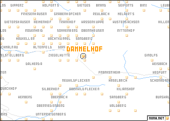
Dammelhof (Hessen, Germany)Dammelhof is a town in the Hessen region of Germany. An overview map of the region around Dammelhof is displayed below.
regional and 3d topo map of Dammelhof, Germany ::
Dammelhof airports ::
The nearest airport is ZNF - Hanau Aaf, located 75.2 km south west of Dammelhof.
Other airports nearby include GHF - Giebelstadt Aaf (87.4 km south), ERF - Erfurt (94.5 km north east), FRA - Frankfurt Main (109.0 km south west), KSF - Kassel Calden (115.3 km north), Nearby towns ::
Rodenbach (NaNkm north) //
Sparbrod (1.2km west) //
Rengersfeld (1.2km west) //
Gersfeld (2.2km north east) //
Mosbach (2.2km north east) //
Rommers (2.4km west) //
Sandberg (3.7km north) //
Dörrenhof (3.0km north west) //
Oberweißenbrunn (3.9km south) //
Schachen (3.9km north) //
Brembach (3.9km north) //
Feldbach (3.9km north) //
Maiersbach (4.4km north west) //
Ziegelhütte (3.5km west) //
Kohlstöcken (5.7km north) //
Schwarzerden (5.7km north) //
Neuwildflecken (5.7km south) //
Obernhausen (5.7km north) //
Sommerberg (6.0km north west) //
Frankenheim (5.1km south east) //
Wachtküppel (5.1km north west) //
Oberwildflecken (7.4km south) //
Wildflecken (7.5km south) //
Sieblos (7.5km north) //
Abtsroda (7.5km north) //
Wasserkuppe (7.5km north) //
Rodholz (6.6km north west) //
Reußendorf (6.6km south west) //
Backtrog (6.0km north west) //
[all distances 'as the bird flies' and approximate]  Places with similar names to Dammelhof, Germany :: Disclaimer :: Information on this page comes without warranty of any kind |
||
|
Where is Dammelhof? Elevation and coordinates ::
Latitude (lat): 50°26'0"N Longitude (lon): 9°56'0"E
Elevation (approx.): 722m (map arrows pan, magnifying glasses zoom) |
||
|
Visiting Dammelhof? Hotel/Accommodation ::
Book a hotel in Dammelhof Travel Guide ::
Buy a travel guide for Germany rental cars ::
car rental offers GPS waypoint ::
download a GPX waypoint (PoI) of Dammelhof for your GPS receiver
|
||