|
search place name
|
||
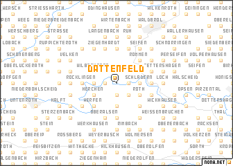
Dattenfeld (Nordrhein-Westfalen, Germany)Dattenfeld is a town in the Nordrhein-Westfalen region of Germany. An overview map of the region around Dattenfeld is displayed below.
regional and 3d topo map of Dattenfeld, Germany ::
Dattenfeld airports ::
The nearest airport is CGN - Cologne Koln Bonn, located 30.8 km west of Dattenfeld.
Other airports nearby include ZNV - Koblenz Winningen (52.9 km south), DUS - Duesseldorf Dusseldorf (78.2 km north west), ZCA - Arnsberg Menden (79.5 km north), DTM - Dortmund (80.0 km north), Nearby towns ::
Dreisel (1.2km east) //
Obersaal (1.9km south) //
Übersetzig (1.2km west) //
Elisenthal (1.9km north) //
Helpenstell (2.2km south east) //
Locksiefen (2.2km south east) //
Leuscheid (3.7km south) //
Mauel (2.3km east) //
Schladern (2.3km east) //
Hoppengarten (2.3km west) //
Roth (3.0km south east) //
Herchen (3.0km south west) //
Rossel (3.0km north west) //
Wilberhofen (3.0km north west) //
Schabernack (4.4km south east) //
Dahlhausen (4.4km south east) //
Himmeroth (4.4km south east) //
Rommen (4.4km north east) //
Werfen (4.4km south west) //
Kocherscheid (5.6km south) //
Kuchhausen (5.6km south) //
Röcklingen (3.5km west) //
Rosbach (3.5km east) //
Niederhausen (5.6km north) //
Spurkenbach (5.7km north) //
Niederalsen (5.7km south) //
Oberalsen (5.7km south) //
Eulenbruch (4.0km south east) //
Obernau (4.0km south east) //
[all distances 'as the bird flies' and approximate]  Places with similar names to Dattenfeld, Germany ::
// Dittenfeld (DE)
// Todenfeld (DE)
Disclaimer :: Information on this page comes without warranty of any kind |
||
|
Where is Dattenfeld? Elevation and coordinates ::
Latitude (lat): 50°48'0"N Longitude (lon): 7°34'0"E
Elevation (approx.): 129m (map arrows pan, magnifying glasses zoom) |
||
|
Visiting Dattenfeld? Hotel/Accommodation ::
Book a hotel in Dattenfeld Travel Guide ::
Buy a travel guide for Germany rental cars ::
car rental offers GPS waypoint ::
download a GPX waypoint (PoI) of Dattenfeld for your GPS receiver
|
||