|
search place name
|
||
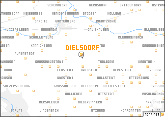
Dielsdorf (Thüringen, Germany)Dielsdorf is a town in the Thüringen region of Germany. An overview map of the region around Dielsdorf is displayed below.
regional and 3d topo map of Dielsdorf, Germany ::
Dielsdorf airports ::
The nearest airport is ERF - Erfurt, located 19.8 km south west of Dielsdorf.
Other airports nearby include LEJ - Leipzig Halle (83.6 km north east), AOC - Altenburg Nobitz (94.9 km east), HOQ - Hof Plauen (102.5 km south east), BYU - Bayreuth (128.5 km south), Nearby towns ::
Markvippach (1.9km south) //
Schloßvippach (2.3km west) //
Bachstedt (3.9km south) //
Sprötau (3.0km north east) //
Vippachedelhausen (3.0km south east) //
Eckstedt (4.4km south west) //
Thalborn (4.0km south east) //
Kleinrudestedt (4.0km south west) //
Orlishausen (6.0km north east) //
Rohrborn (6.0km north west) //
Udestedt (6.0km south west) //
Ollendorf (7.5km south) //
Frohndorf (7.5km north) //
Großrudestedt (5.0km west) //
Ballstedt (6.6km south east) //
Gartenberg (7.8km north) //
Großmölsen (7.8km south) //
Kiebitzhöhe (8.2km north east) //
Sömmerda (7.2km north west) //
Kleinmölsen (8.2km south west) //
Hottelstedt (8.8km south east) //
[all distances 'as the bird flies' and approximate]  Places with similar names to Dielsdorf, Germany ::
// Dielsdorf (CH)
Disclaimer :: Information on this page comes without warranty of any kind |
||
|
Where is Dielsdorf? Elevation and coordinates ::
Latitude (lat): 51°6'0"N Longitude (lon): 11°10'0"E
Elevation (approx.): 196m (map arrows pan, magnifying glasses zoom) |
||
|
Visiting Dielsdorf? Hotel/Accommodation ::
Book a hotel in Dielsdorf Travel Guide ::
Buy a travel guide for Germany rental cars ::
car rental offers GPS waypoint ::
download a GPX waypoint (PoI) of Dielsdorf for your GPS receiver
|
||