|
search place name
|
||
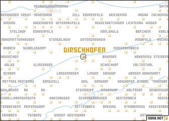
Dirschhofen (Bayern, Germany)Dirschhofen is a town in the Bayern region of Germany. An overview map of the region around Dirschhofen is displayed below.
regional and 3d topo map of Dirschhofen, Germany ::
Dirschhofen airports ::
The nearest airport is AGB - Augsburg, located 33.0 km south west of Dirschhofen.
Other airports nearby include FEL - Fuerstenfeldbruck Furstenfeldbruck (47.6 km south), MUC - Munich Munchen (50.4 km south east), OBF - Oberpfaffenhofen (61.4 km south), NUE - Nuernberg Nurnberg (97.2 km north), Nearby towns ::
Berg im Gau (0.0km north) //
Alteneich (1.2km east) //
Lampertshofen (1.2km west) //
Oberarnbach (1.2km east) //
Siefhofen (1.2km east) //
Obergrasheim (1.9km north) //
Eppertshofen (2.2km south west) //
Dettenhofen (2.2km north east) //
Edelshausen (3.1km south east) //
Linden (3.9km south) //
Untergrasheim (3.9km north) //
Langenmosen (4.4km south west) //
Weil (5.6km south) //
Brunnen (3.7km east) //
Schachhof (4.1km south east) //
Gerstetten (4.1km south east) //
Högenau (5.7km south) //
Grasheim (5.7km north) //
Gaishof (5.2km south east) //
Königslachen (6.1km south east) //
Sandhof (6.1km south east) //
Winkelhausen (5.2km south west) //
Stengelheim (5.2km north west) //
Steingriff (7.4km south) //
Ludwigsmoos (5.2km west) //
Rosing (7.5km north) //
Kochheim (7.5km north) //
Karlshuld (6.7km north east) //
Mühlried (7.8km south) //
[all distances 'as the bird flies' and approximate] 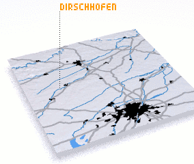 Places with similar names to Dirschhofen, Germany ::
Disclaimer :: Information on this page comes without warranty of any kind |
||
|
Where is Dirschhofen? Elevation and coordinates ::
Latitude (lat): 48°38'0"N Longitude (lon): 11°15'0"E
Elevation (approx.): 391m (map arrows pan, magnifying glasses zoom) |
||
|
Visiting Dirschhofen? Hotel/Accommodation ::
Book a hotel in Dirschhofen Travel Guide ::
Buy a travel guide for Germany rental cars ::
car rental offers GPS waypoint ::
download a GPX waypoint (PoI) of Dirschhofen for your GPS receiver
|
||