|
search place name
|
||
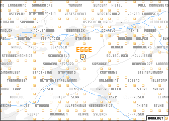
Egge (Nordrhein-Westfalen, Germany)Egge is a town in the Nordrhein-Westfalen region of Germany. An overview map of the region around Egge is displayed below.
regional and 3d topo map of Egge, Germany ::
Egge airports ::
The nearest airport is GUT - Guetersloh Gutersloh, located 37.8 km south west of Egge.
Other airports nearby include PAD - Paderborn Lippstadt (60.0 km south), FMO - Muenster/osnabrueck Munster Osnabruck (70.7 km west), HAJ - Hannover (74.6 km north east), ZCA - Arnsberg Menden (93.2 km south west), Nearby towns ::
Hofe (0.0km north) //
Homberg (1.1km west) //
Groß Schwarzenmoor (1.9km south) //
Hanschenberg (2.2km south west) //
Bischofshagen (3.7km north) //
Steinsiek (3.7km north) //
Falkendiek (2.3km west) //
Kipshagen (2.9km south east) //
Herford (2.9km south west) //
Stiftberg (4.3km south west) //
Löhnerheide (4.3km north west) //
Löhnebeck (4.3km north west) //
Falscheide (4.3km north west) //
Auf dem Kartel (3.4km west) //
Schweicheln (3.4km west) //
Dekanat (3.4km west) //
Arnholz (3.4km east) //
Mahnen (5.6km north) //
Bahnhof Löhne (5.6km north) //
Bermbeck (3.9km north west) //
Hollenhagen (3.9km south east) //
Heideholz (3.9km north east) //
Obernbeck (5.7km north) //
Krutheide (5.0km south east) //
Oberbehme (5.0km north west) //
Löhne (5.0km north west) //
Jöllenbeck (5.0km north east) //
Depenbrock (6.0km north) //
Friedenstal (6.0km south) //
[all distances 'as the bird flies' and approximate] 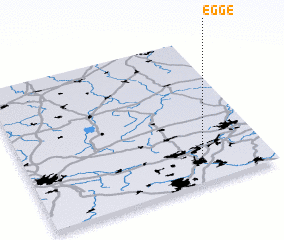 Places with similar names to Egge, Germany ::
Disclaimer :: Information on this page comes without warranty of any kind |
||
|
Where is Egge? Elevation and coordinates ::
Latitude (lat): 52°9'0"N Longitude (lon): 8°43'0"E
Elevation (approx.): 146m (map arrows pan, magnifying glasses zoom) |
||
|
Visiting Egge? Hotel/Accommodation ::
Book a hotel in Egge Travel Guide ::
Buy a travel guide for Germany rental cars ::
car rental offers GPS waypoint ::
download a GPX waypoint (PoI) of Egge for your GPS receiver
|
||