|
search place name
|
||
Ehenfeld (Bayern, Germany)Ehenfeld is a town in the Bayern region of Germany. An overview map of the region around Ehenfeld is displayed below.
regional and 3d topo map of Ehenfeld, Germany ::

Ehenfeld airports ::
The nearest airport is BYU - Bayreuth, located 49.9 km north west of Ehenfeld.
Other airports nearby include NUE - Nuernberg Nurnberg (64.6 km west), HOQ - Hof Plauen (78.8 km north), KLV - Karlovy Vary (97.8 km north east), MUC - Munich Munchen (137.3 km south), Nearby towns ::
Rödlas (1.9km north) //
Massenricht (1.9km north) //
Träglhof (1.9km north) //
Obersteinbach (2.2km north east) //
Kindlas (3.0km south east) //
Untersteinbach (3.0km north east) //
Hirschau (4.3km south) //
Elbart (4.4km north west) //
Freihung (4.4km north west) //
Schickenhof (5.6km north) //
Konradinsgrund (5.6km north) //
Thansüß (5.7km north) //
Weickenricht (4.1km north west) //
Thannhof (4.1km north east) //
Scharhof (6.1km south east) //
Dürnast (6.1km north east) //
Forst (5.2km south east) //
Blauenneuschacht (5.2km north west) //
Röthenbach (5.2km north east) //
Kricklhof (7.4km south) //
Kleinschönbrunn (4.8km west) //
Kaltenbrunn (7.4km north) //
Weiher (7.5km south) //
Großschönbrunn (5.2km west) //
Krickelsdorf (5.2km west) //
Seugast (5.2km west) //
Kohlberg (5.2km east) //
Rothhaar (6.6km north west) //
Krondorf (6.6km south west) //
[all distances 'as the bird flies' and approximate] 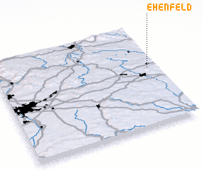 Places with similar names to Ehenfeld, Germany :: Disclaimer :: Information on this page comes without warranty of any kind |
||
|
Where is Ehenfeld? Elevation and coordinates ::
Latitude (lat): 49°35'0"N Longitude (lon): 11°57'0"E
Elevation (approx.): 552m (map arrows pan, magnifying glasses zoom) |
||
|
Visiting Ehenfeld? Hotel/Accommodation ::
Book a hotel in Ehenfeld Travel Guide ::
Buy a travel guide for Germany rental cars ::
car rental offers GPS waypoint ::
download a GPX waypoint (PoI) of Ehenfeld for your GPS receiver
|
||