|
search place name
|
||
Eiche-Golm (Brandenburg, Germany)Eiche-Golm is a town in the Brandenburg region of Germany. An overview map of the region around Eiche-Golm is displayed below.
regional and 3d topo map of Eiche-Golm, Germany ::

Eiche-Golm airports ::
The nearest airport is TXL - Berlin Tegel, located 28.1 km north east of Eiche-Golm.
Other airports nearby include THF - Berlin Tempelhof (30.8 km east), SXF - Berlin Schonefeld (37.9 km east), LEJ - Leipzig Halle (118.7 km south west), SZW - Schwerin Parchim (139.3 km north west), Nearby towns ::
Golm (0.0km north) //
Kuhfort (1.1km east) //
Eiche (1.1km east) //
Gallin (2.2km south west) //
Wildpark West (2.2km south west) //
Werder (2.2km south west) //
Neu Grube (3.7km north) //
Geltow (3.9km south) //
Bornim (3.9km north) //
Grube (3.9km north) //
Nattwerder (4.3km north west) //
Leest (4.3km north west) //
Franzensberg (5.6km south) //
Kolonie Roeske (3.4km west) //
Schlänitzsee (5.6km north) //
Marquardt (5.6km north) //
Glindow (5.0km south west) //
Caputh (6.0km south) //
Alt Töplitz (5.0km north west) //
Petzow (6.0km south) //
Eichholz (6.0km north) //
Flottstelle (7.4km south) //
Bornstedt (4.9km east) //
Hermannswerder (4.9km east) //
Brandenburger Vorstadt (4.9km east) //
Weinberg (7.5km north) //
Friedrichshöhe (7.5km south) //
Kolonie Zern (4.9km west) //
Satzkorn (7.8km north) //
[all distances 'as the bird flies' and approximate] 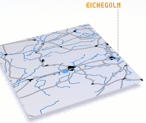 Places with similar names to Eiche-Golm, Germany :: Disclaimer :: Information on this page comes without warranty of any kind |
||
|
Where is Eiche-Golm? Elevation and coordinates ::
Latitude (lat): 52°24'0"N Longitude (lon): 12°58'0"E
Elevation (approx.): 29m (map arrows pan, magnifying glasses zoom) |
||
|
Visiting Eiche-Golm? Hotel/Accommodation ::
Book a hotel in Eiche-Golm Travel Guide ::
Buy a travel guide for Germany rental cars ::
car rental offers GPS waypoint ::
download a GPX waypoint (PoI) of Eiche-Golm for your GPS receiver
|
||