|
search place name
|
||
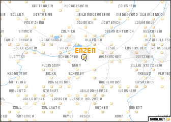
Enzen (Nordrhein-Westfalen, Germany)Enzen is a town in the Nordrhein-Westfalen region of Germany. An overview map of the region around Enzen is displayed below.
regional and 3d topo map of Enzen, Germany ::
Enzen airports ::
The nearest airport is CGN - Cologne Koln Bonn, located 40.3 km north east of Enzen.
Other airports nearby include GKE - Geilenkirchen (56.9 km north west), MGL - Moenchengladbach Monchengladbach (65.8 km north), ZNV - Koblenz Winningen (70.0 km south east), MST - Maastricht (70.7 km north west), Nearby towns ::
Linzenich (2.2km north west) //
Gehn (2.2km south west) //
Firmenich (2.2km south west) //
Obergartzem (2.2km south east) //
Schwerfen (2.4km west) //
Schaven (3.9km south) //
Lövenich (3.9km north) //
Satzvey (3.9km south) //
Sinzenich (3.0km north west) //
Floren (3.0km north west) //
Ülpenich (3.9km north) //
Dürscheven (3.0km north east) //
Kommern (4.4km south west) //
Hoven (4.4km north west) //
Wißkirchen (3.5km east) //
Nemmenich (5.6km north) //
Elsig (4.0km north east) //
Merzenich (4.0km north west) //
Oberelvenich (5.7km north) //
Mechernich (6.0km south west) //
Frauenberg (5.1km north east) //
Zülpich (6.0km north west) //
Lessenich (6.0km south east) //
Niederelvenich (6.0km north east) //
Katzvey (7.4km south) //
Rövenich (7.4km north) //
Euenheim (4.7km east) //
Floisdorf (5.1km west) //
Kommern Süd (7.5km south) //
[all distances 'as the bird flies' and approximate]  Places with similar names to Enzen, Germany ::
Disclaimer :: Information on this page comes without warranty of any kind |
||
|
Where is Enzen? Elevation and coordinates ::
Latitude (lat): 50°39'0"N Longitude (lon): 6°41'0"E
Elevation (approx.): 198m (map arrows pan, magnifying glasses zoom) |
||
|
Visiting Enzen? Hotel/Accommodation ::
Book a hotel in Enzen Travel Guide ::
Buy a travel guide for Germany rental cars ::
car rental offers GPS waypoint ::
download a GPX waypoint (PoI) of Enzen for your GPS receiver
|
||