|
search place name
|
||
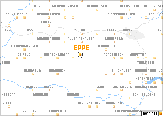
Eppe (Hessen, Germany)Eppe is a town in the Hessen region of Germany. An overview map of the region around Eppe is displayed below.
regional and 3d topo map of Eppe, Germany ::
Eppe airports ::
The nearest airport is PAD - Paderborn Lippstadt, located 43.6 km north of Eppe.
Other airports nearby include KSF - Kassel Calden (46.8 km north east), ZCA - Arnsberg Menden (66.5 km north west), GUT - Guetersloh Gutersloh (83.1 km north), DTM - Dortmund (86.4 km west), Nearby towns ::
Nieder-Schleidern (1.2km west) //
Hillershausen (2.2km south west) //
Alleringhausen (3.7km north) //
Welleringhausen (4.4km north west) //
Oberschledorn (3.5km west) //
Bömighausen (5.6km north) //
Goldhausen (3.9km north east) //
Goddelsheim (5.1km south east) //
Medebach (5.1km south west) //
Rhena (6.0km north east) //
Neerdar (6.0km north west) //
Oberense (4.6km east) //
Nordenbeck (4.6km east) //
Schaaken (5.9km south east) //
Rhadern (7.8km south) //
Lengefeld (5.9km north east) //
Düdinghausen (5.9km north west) //
Lelbach (7.2km north east) //
Berge (8.7km south west) //
Eimelrod (8.7km north west) //
[all distances 'as the bird flies' and approximate] 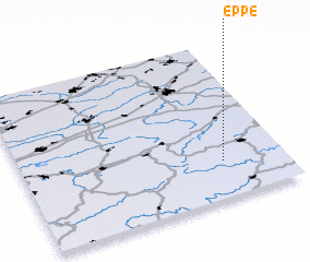 Places with similar names to Eppe, Germany ::
Disclaimer :: Information on this page comes without warranty of any kind |
||
|
Where is Eppe? Elevation and coordinates ::
Latitude (lat): 51°14'0"N Longitude (lon): 8°46'0"E
Elevation (approx.): 361m (map arrows pan, magnifying glasses zoom) |
||
|
Visiting Eppe? Hotel/Accommodation ::
Book a hotel in Eppe Travel Guide ::
Buy a travel guide for Germany rental cars ::
car rental offers GPS waypoint ::
download a GPX waypoint (PoI) of Eppe for your GPS receiver
|
||