|
search place name
|
||
Essenheim (Rheinland-Pfalz, Germany)Essenheim is a town in the Rheinland-Pfalz region of Germany. An overview map of the region around Essenheim is displayed below.
regional and 3d topo map of Essenheim, Germany ::

Essenheim airports ::
The nearest airport is FRA - Frankfurt Main, located 29.8 km east of Essenheim.
Other airports nearby include MHG - Mannheim City (57.1 km south east), ZNV - Koblenz Winningen (62.8 km north west), ZNF - Hanau Aaf (63.5 km north east), HHN - Frankfurt Hahn (64.0 km west), Nearby towns ::
Windhäuserhof (1.6km west) //
Stadecken (3.0km south west) //
Ober-Olm (2.5km east) //
Stadecken-Elsheim (3.0km south west) //
Elsheim (2.8km south west) //
Lerchenberg (4.2km north east) //
Haxthäuserhof (4.9km north west) //
Nieder-Saulheim (6.1km south) //
Drais (5.5km north east) //
Klein-Winternheim (4.1km east) //
Wackernheim (5.6km north west) //
Nieder-Olm (4.5km south east) //
Finthen (6.6km north) //
Schwabenheim (4.4km west) //
Sörgenloch (6.2km south east) //
Udenheim (7.4km south) //
Ober-Saulheim (7.5km south) //
Heidesheim (8.0km north) //
Bubenheim (5.5km west) //
Groß-Winternheim (5.6km west) //
Marienborn (6.2km north east) //
Jugenheim (6.4km south west) //
Zornheim (6.7km south east) //
Partenheim (7.4km south west) //
Heidenfahrt (8.7km north west) //
Gonsenheim (8.9km north east) //
Bretzenheim (8.1km north east) //
Wahlheimer Hof (9.0km south east) //
[all distances 'as the bird flies' and approximate] 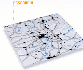 Places with similar names to Essenheim, Germany ::
// Eußenheim (DE)
Disclaimer :: Information on this page comes without warranty of any kind |
||
|
Where is Essenheim? Elevation and coordinates ::
Latitude (lat): 49°55'50"N Longitude (lon): 8°9'20"E
Elevation (approx.): 212m (map arrows pan, magnifying glasses zoom) |
||
|
Visiting Essenheim? Hotel/Accommodation ::
Book a hotel in Essenheim Travel Guide ::
Buy a travel guide for Germany rental cars ::
car rental offers GPS waypoint ::
download a GPX waypoint (PoI) of Essenheim for your GPS receiver
|
||