|
search place name
|
||
Eulenthal (Bayern, Germany)Eulenthal is a town in the Bayern region of Germany. An overview map of the region around Eulenthal is displayed below.
regional and 3d topo map of Eulenthal, Germany ::

Eulenthal airports ::
The nearest airport is FEL - Fuerstenfeldbruck Furstenfeldbruck, located 29.4 km south of Eulenthal.
Other airports nearby include AGB - Augsburg (30.1 km west), MUC - Munich Munchen (35.8 km east), OBF - Oberpfaffenhofen (43.0 km south), NUE - Nuernberg Nurnberg (116.4 km north), Nearby towns ::
Junkenhofen (1.2km west) //
Duckenried (1.9km north) //
Arnsried (1.9km north) //
Alberzell (1.9km south) //
Stadelham (1.9km south) //
Klenau (2.2km north west) //
Eichenried (2.2km south east) //
Kemnat (2.5km west) //
Weichselbaum (3.7km north) //
Gartelsried (3.7km south) //
Felbern (2.5km east) //
Wolfertshausen (2.5km east) //
Labersdorf (3.1km north west) //
Gütersberg (3.1km north west) //
Neuhof (3.9km north) //
Stockhausen (3.9km north) //
Labersberg (3.9km north) //
Niederdorf (3.9km south) //
Oberdorf (3.9km south) //
Hilgertshausen-Tandern (3.9km south) //
Mannried (3.9km south) //
Hirschenhausen (3.1km south east) //
Garbertshausen (3.1km south east) //
Oberweilenbach (4.4km north west) //
Unterweilenbach (4.4km north west) //
Tandern (4.4km south west) //
Gerolsbach (4.4km north east) //
Bergern (4.4km north east) //
Singenbach (4.4km north east) //
[all distances 'as the bird flies' and approximate] 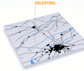
Disclaimer :: Information on this page comes without warranty of any kind |
||
|
Where is Eulenthal? Elevation and coordinates ::
Latitude (lat): 48°28'0"N Longitude (lon): 11°20'0"E
Elevation (approx.): 526m (map arrows pan, magnifying glasses zoom) |
||
|
Visiting Eulenthal? Hotel/Accommodation ::
Book a hotel in Eulenthal Travel Guide ::
Buy a travel guide for Germany rental cars ::
car rental offers GPS waypoint ::
download a GPX waypoint (PoI) of Eulenthal for your GPS receiver
|
||