|
search place name
|
||
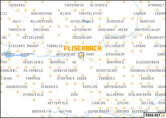
Flischbach (Bayern, Germany)Flischbach is a town in the Bayern region of Germany. An overview map of the region around Flischbach is displayed below.
regional and 3d topo map of Flischbach, Germany ::
Flischbach airports ::
The nearest airport is KLV - Karlovy Vary, located 99.4 km north of Flischbach.
Other airports nearby include BYU - Bayreuth (100.3 km north west), NUE - Nuernberg Nurnberg (112.8 km west), HOQ - Hof Plauen (119.0 km north west), MUC - Munich Munchen (124.2 km south west), Nearby towns ::
Flischberg (0.0km north) //
Rhan (1.2km east) //
Schönthal (1.9km north) //
Kleinschönthal (1.9km north) //
Löwendorf (2.2km south east) //
Öd (2.2km south west) //
Wenzenried (2.4km west) //
Steegen (2.4km west) //
Döfering (2.4km east) //
Lixendöfering (2.4km east) //
Beutelsbach (3.7km south) //
Trosendorf (3.7km north) //
Schatzendorf (4.4km south west) //
Albersdorf (4.4km south west) //
Grafenkirchen (4.4km south east) //
Premeischl (4.4km north west) //
Kritzenast (4.4km north east) //
Thurau (4.4km north east) //
Rackelsdorf (5.6km south) //
Kager (5.6km south) //
Loitendorf (5.6km north) //
Gmünd (3.6km west) //
Haschaberg (3.6km east) //
Bernried (4.1km south west) //
Oberdeschenried (5.7km south) //
Hiltersried (5.7km north) //
Engelsdorf (5.7km south) //
Trobelsdorf (4.1km north west) //
Grub (4.1km north west) //
[all distances 'as the bird flies' and approximate]  Places with similar names to Flischbach, Germany :: Disclaimer :: Information on this page comes without warranty of any kind |
||
|
Where is Flischbach? Elevation and coordinates ::
Latitude (lat): 49°20'0"N Longitude (lon): 12°36'0"E
Elevation (approx.): 508m (map arrows pan, magnifying glasses zoom) |
||
|
Visiting Flischbach? Hotel/Accommodation ::
Book a hotel in Flischbach Travel Guide ::
Buy a travel guide for Germany rental cars ::
car rental offers GPS waypoint ::
download a GPX waypoint (PoI) of Flischbach for your GPS receiver
|
||