|
search place name
|
||
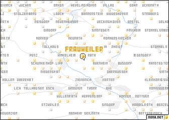
Frauweiler (Nordrhein-Westfalen, Germany)Frauweiler is a town in the Nordrhein-Westfalen region of Germany. An overview map of the region around Frauweiler is displayed below.
regional and 3d topo map of Frauweiler, Germany ::
Frauweiler airports ::
The nearest airport is MGL - Moenchengladbach Monchengladbach, located 26.8 km north of Frauweiler.
Other airports nearby include DUS - Duesseldorf Dusseldorf (33.9 km north), CGN - Cologne Koln Bonn (39.9 km east), GKE - Geilenkirchen (40.6 km west), ESS - Essen Mulheim (50.1 km north east), Nearby towns ::
Rath (1.2km east) //
Garsdorf (1.2km east) //
Buchholz (1.2km west) //
Harfereiche (1.9km south) //
Montagsend (1.9km south) //
Wiedenfeld (1.9km south) //
Holtrop (2.2km south east) //
Ingenfeld (3.7km north) //
Bedburg (2.3km west) //
Winkelheim (2.3km west) //
Auenheim (3.0km south east) //
Vanikum (3.0km north east) //
Neurath (3.9km north) //
Bergheim (4.4km south east) //
Glesch (4.4km south west) //
Zieverich (5.6km south) //
Krahwinkel (5.6km north) //
Broich (3.5km west) //
Geddenberg (3.5km west) //
Groß Mönchhof (3.5km east) //
Klein Mönchhof (3.5km east) //
Bongarderhof (5.7km north) //
Paffendorf (5.7km south) //
Priorshof (4.0km north west) //
Oberschlag (4.0km north west) //
Blerichen (4.0km south west) //
Lipp (4.0km south west) //
Geretzhoven (4.0km north east) //
Niederaußem (4.0km south east) //
[all distances 'as the bird flies' and approximate]  Places with similar names to Frauweiler, Germany ::
// Fürweiler (DE)
Disclaimer :: Information on this page comes without warranty of any kind |
||
|
Where is Frauweiler? Elevation and coordinates ::
Latitude (lat): 51°0'0"N Longitude (lon): 6°37'0"E
Elevation (approx.): 80m (map arrows pan, magnifying glasses zoom) |
||
|
Visiting Frauweiler? Hotel/Accommodation ::
Book a hotel in Frauweiler Travel Guide ::
Buy a travel guide for Germany rental cars ::
car rental offers GPS waypoint ::
download a GPX waypoint (PoI) of Frauweiler for your GPS receiver
|
||