|
search place name
|
||
Gellin (Mecklenburg-Vorpommern, Germany)Gellin is a town in the Mecklenburg-Vorpommern region of Germany. An overview map of the region around Gellin is displayed below.
regional and 3d topo map of Gellin, Germany ::

Gellin airports ::
The nearest airport is SZZ - Szczechin Goleniow, located 41.6 km east of Gellin.
Other airports nearby include TXL - Berlin Tegel (120.8 km south west), THF - Berlin Tempelhof (124.8 km south west), SXF - Berlin Schonefeld (130.5 km south west), IEG - Zielona Gora Babimost (176.9 km south east), Nearby towns ::
Bismark (0.0km north) //
Hohenfelde (1.9km north) //
Schmagerow (2.2km south west) //
Grenzdorf (2.2km east) //
Grambow (3.9km south) //
Ramin (4.3km south west) //
Retzin (4.3km south west) //
Marienhof (3.3km east) //
Neu-Lienken (3.3km east) //
Sonnenberg (5.6km south) //
Linken (3.8km north east) //
Plöwen (3.8km north west) //
Buk (6.0km north) //
Boock (5.0km north west) //
Blankensee (7.4km north) //
Salzow (4.8km south west) //
Schwennenz (6.5km south east) //
Glasow (8.1km south west) //
Bobolin (8.6km south east) //
Mewegen (8.6km north west) //
[all distances 'as the bird flies' and approximate] 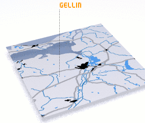 Places with similar names to Gellin, Germany ::
Disclaimer :: Information on this page comes without warranty of any kind |
||
|
Where is Gellin? Elevation and coordinates ::
Latitude (lat): 53°27'0"N Longitude (lon): 14°19'0"E
Elevation (approx.): 27m (map arrows pan, magnifying glasses zoom) |
||
|
Visiting Gellin? Hotel/Accommodation ::
Book a hotel in Gellin Travel Guide ::
Buy a travel guide for Germany rental cars ::
car rental offers GPS waypoint ::
download a GPX waypoint (PoI) of Gellin for your GPS receiver
|
||