|
search place name
|
||
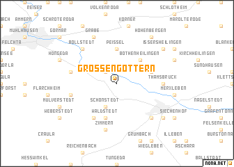
Großengottern (Thüringen, Germany)Großengottern is a town in the Thüringen region of Germany. An overview map of the region around Großengottern is displayed below.
regional and 3d topo map of Großengottern, Germany ::
Großengottern airports ::
The nearest airport is ERF - Erfurt, located 32.4 km south east of Großengottern.
Other airports nearby include KSF - Kassel Calden (88.9 km west), LEJ - Leipzig Halle (119.9 km east), BWE - Braunschweig Wolfsburg (130.1 km north), HOQ - Hof Plauen (131.3 km south east), Nearby towns ::
Altengottern (2.2km north west) //
Schönstedt (3.9km south) //
Bothenheilingen (4.4km north east) //
Peißel (5.6km north) //
Waldstedt (5.7km south) //
Großwelsbach (3.9km north east) //
Alterstedt (6.0km south west) //
Thamsbrück (4.7km east) //
Seebach (5.0km west) //
Heroldishausen (5.0km west) //
Zimmern (7.5km south) //
Ufhoven (6.6km south east) //
Bollstedt (6.6km north west) //
Grabe (7.8km north) //
Bad Langensalza (7.2km south east) //
Hohenbergen (8.2km north east) //
Issersheilingen (7.2km north east) //
[all distances 'as the bird flies' and approximate] 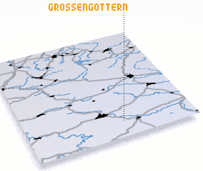 Places with similar names to Großengottern, Germany :: Disclaimer :: Information on this page comes without warranty of any kind |
||
|
Where is Großengottern? Elevation and coordinates ::
Latitude (lat): 51°9'0"N Longitude (lon): 10°35'0"E
Elevation (approx.): 176m (map arrows pan, magnifying glasses zoom) |
||
|
Visiting Großengottern? Hotel/Accommodation ::
Book a hotel in Großengottern Travel Guide ::
Buy a travel guide for Germany rental cars ::
car rental offers GPS waypoint ::
download a GPX waypoint (PoI) of Großengottern for your GPS receiver
|
||