|
search place name
|
||
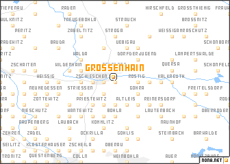
Großenhain (Sachsen, Germany)Großenhain is a town in the Sachsen region of Germany. An overview map of the region around Großenhain is displayed below.
regional and 3d topo map of Großenhain, Germany ::
Großenhain airports ::
The nearest airport is DRS - Dresden, located 22.6 km south east of Großenhain.
Other airports nearby include BBJ - Bautzen (68.5 km east), AOC - Altenburg Nobitz (80.4 km south west), LEJ - Leipzig Halle (92.6 km west), SXF - Berlin Schonefeld (122.0 km north), Nearby towns ::
Weßnitz (0.0km north) //
Bobersberg (0.0km north) //
Naundorf (1.9km north) //
Mülbitz (1.2km west) //
Zschauitz (2.2km south west) //
Rodeland (2.3km east) //
Rostig (2.3km east) //
Zschieschen (2.3km west) //
Dallwitz (3.7km south) //
Lenz (3.7km south) //
Döbritzchen (3.7km south) //
Göhra (3.0km south east) //
Kottewitz (3.9km south) //
Altleis (3.9km south) //
Nauleis (4.4km south east) //
Priestewitz (4.4km south west) //
Dorf der Jugend (4.4km north east) //
Folbern (3.5km east) //
Großraschütz (3.5km west) //
Böhla (5.6km south) //
Strießen (3.9km south west) //
Nasseböhla (5.7km north) //
Uebigau (5.7km north) //
Skaup (5.7km north) //
Kleinraschütz (3.9km north west) //
Geißlitz (5.7km south) //
Baßlitz (5.7km south) //
Skässchen (6.0km north east) //
Hohndorf (5.1km south east) //
[all distances 'as the bird flies' and approximate]  Places with similar names to Großenhain, Germany ::
// Großenhain (DE)
Disclaimer :: Information on this page comes without warranty of any kind |
||
|
Where is Großenhain? Elevation and coordinates ::
Latitude (lat): 51°17'0"N Longitude (lon): 13°33'0"E
Elevation (approx.): 139m (map arrows pan, magnifying glasses zoom) |
||
|
Visiting Großenhain? Hotel/Accommodation ::
Book a hotel in Großenhain Travel Guide ::
Buy a travel guide for Germany rental cars ::
car rental offers GPS waypoint ::
download a GPX waypoint (PoI) of Großenhain for your GPS receiver
|
||