|
search place name
|
||
Großenlinden (Hessen, Germany)Großenlinden is a town in the Hessen region of Germany. An overview map of the region around Großenlinden is displayed below.
regional and 3d topo map of Großenlinden, Germany ::

Großenlinden airports ::
The nearest airport is ZNF - Hanau Aaf, located 46.2 km south east of Großenlinden.
Other airports nearby include FRA - Frankfurt Main (56.9 km south), ZNV - Koblenz Winningen (83.0 km west), KSF - Kassel Calden (109.9 km north east), CGN - Cologne Koln Bonn (112.7 km west), Nearby towns ::
Leihgestern (2.2km south east) //
Rindsmühle (2.2km south west) //
Hörnsheim (2.2km south west) //
Lützellinden (2.4km west) //
Klein Linden (3.7km north) //
Hochelheim (3.0km south west) //
Allendorf an der Lahn (3.0km north west) //
Langgöns (3.9km south) //
Dornholzhausen (4.4km south west) //
Gießen (5.6km north) //
Steinberg (3.5km east) //
Heuchelheim (5.7km north) //
Kinzenbach (6.0km north west) //
Niederkleen (6.0km south west) //
Dutenhofen (5.1km north west) //
Pohl Göns (7.4km south) //
Kirch Göns (7.4km south) //
Watzenborn (4.7km east) //
Kleinrechtenbach (5.1km west) //
Münchholzhausen (5.1km west) //
Oberkleen (8.2km south west) //
Wieseck (8.2km north east) //
Atzbach (7.3km north west) //
Holzheim (7.3km south east) //
[all distances 'as the bird flies' and approximate] 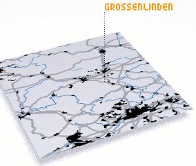 Places with similar names to Großenlinden, Germany :: Disclaimer :: Information on this page comes without warranty of any kind |
||
|
Where is Großenlinden? Elevation and coordinates ::
Latitude (lat): 50°32'0"N Longitude (lon): 8°39'0"E
Elevation (approx.): 187m (map arrows pan, magnifying glasses zoom) |
||
|
Visiting Großenlinden? Hotel/Accommodation ::
Book a hotel in Großenlinden Travel Guide ::
Buy a travel guide for Germany rental cars ::
car rental offers GPS waypoint ::
download a GPX waypoint (PoI) of Großenlinden for your GPS receiver
|
||