|
search place name
|
||
Großhöhenrain (Bayern, Germany)Großhöhenrain is a town in the Bayern region of Germany. An overview map of the region around Großhöhenrain is displayed below.
regional and 3d topo map of Großhöhenrain, Germany ::

Großhöhenrain airports ::
The nearest airport is MUC - Munich Munchen, located 47.5 km north of Großhöhenrain.
Other airports nearby include OBF - Oberpfaffenhofen (48.9 km west), FEL - Fuerstenfeldbruck Furstenfeldbruck (56.1 km north west), SZG - Salzburg (84.1 km east), INN - Innsbruck (85.7 km south west), Nearby towns ::
Thal (0.0km north) //
Riedbichl (0.0km north) //
Gmeinwieß (0.0km north) //
Kleinhöhenrain (1.9km south) //
Hub (1.9km south) //
Reisachöd (1.2km west) //
Haag (1.2km west) //
Krügling (1.2km west) //
Höhenrain (1.2km west) //
Elendskirchen (1.2km west) //
Baiern (1.9km north) //
Weidach (1.9km north) //
Piusheim (1.9km north) //
Voglried (2.2km south east) //
Aschhofen (2.2km south west) //
Hornau (2.2km south east) //
Haus (2.2km north east) //
Kleinesterndorf (2.2km north east) //
Hub (2.2km north east) //
Antholing (2.2km north east) //
Großesterndorf (2.2km north east) //
Hirschberg (2.5km east) //
Oberwall (2.5km east) //
Oberholzham (2.5km east) //
Hofberg (2.5km west) //
Eutenhausen (2.5km west) //
Unterlaus (2.5km west) //
Bretzen (3.7km north) //
Obermühle (3.7km north) //
[all distances 'as the bird flies' and approximate] 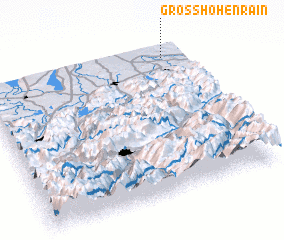 Places with similar names to Großhöhenrain, Germany :: Disclaimer :: Information on this page comes without warranty of any kind |
||
|
Where is Großhöhenrain? Elevation and coordinates ::
Latitude (lat): 47°56'0"N Longitude (lon): 11°54'0"E
Elevation (approx.): 554m (map arrows pan, magnifying glasses zoom) |
||
|
Visiting Großhöhenrain? Hotel/Accommodation ::
Book a hotel in Großhöhenrain Travel Guide ::
Buy a travel guide for Germany rental cars ::
car rental offers GPS waypoint ::
download a GPX waypoint (PoI) of Großhöhenrain for your GPS receiver
|
||