|
search place name
|
||
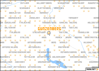
Gunzenberg (Bayern, Germany)Gunzenberg is a town in the Bayern region of Germany. An overview map of the region around Gunzenberg is displayed below.
regional and 3d topo map of Gunzenberg, Germany ::
Gunzenberg airports ::
The nearest airport is SZG - Salzburg, located 32.8 km south east of Gunzenberg.
Other airports nearby include MUC - Munich Munchen (80.0 km north west), LNZ - Linz (Horsching) (109.3 km east), OBF - Oberpfaffenhofen (109.5 km west), FEL - Fuerstenfeldbruck Furstenfeldbruck (112.1 km west), Nearby towns ::
Inzing (1.9km south) //
Törring (1.9km south) //
Kay (1.9km north) //
Wiesmühl (1.2km west) //
Münichham (1.2km west) //
Ramsdorf (1.2km east) //
Weilham (2.2km south west) //
Haus (2.2km south west) //
Salling (2.2km north west) //
Piesenberg (2.5km east) //
Stackendorf (2.5km west) //
Mayerhofen (2.5km east) //
Lohen (2.5km west) //
Holzhausen (2.5km east) //
Gramsham (2.5km east) //
Helmberg (2.5km west) //
Kuglthal (2.5km west) //
Traßmiething (3.7km north) //
Pfaffing (3.7km north) //
Diepling (3.7km north) //
Dandlberg (3.7km north) //
Grassach (3.7km north) //
Mühlham (3.7km north) //
Hof (3.1km south east) //
Pirach (3.1km south east) //
Kirchheim (3.1km north east) //
Ollerding (3.1km north west) //
Hörzing (3.1km north east) //
Tengling (3.9km south) //
[all distances 'as the bird flies' and approximate]  Places with similar names to Gunzenberg, Germany ::
// Gunzenberg (AT)
// Gunzenberg (AT)
// Gunzenberg (DE)
// Konzenberg (DE)
// Kunzenberg (DE)
// Kinzenburg (DE)
Disclaimer :: Information on this page comes without warranty of any kind |
||
|
Where is Gunzenberg? Elevation and coordinates ::
Latitude (lat): 48°2'0"N Longitude (lon): 12°45'0"E
Elevation (approx.): 419m (map arrows pan, magnifying glasses zoom) |
||
|
Visiting Gunzenberg? Hotel/Accommodation ::
Book a hotel in Gunzenberg Travel Guide ::
Buy a travel guide for Germany rental cars ::
car rental offers GPS waypoint ::
download a GPX waypoint (PoI) of Gunzenberg for your GPS receiver
|
||