|
search place name
|
||
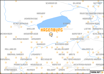
Hagenburg (Niedersachsen, Germany)Hagenburg is a town in the Niedersachsen region of Germany. An overview map of the region around Hagenburg is displayed below.
regional and 3d topo map of Hagenburg, Germany ::
Hagenburg airports ::
The nearest airport is HAJ - Hannover, located 24.1 km east of Hagenburg.
Other airports nearby include ZCN - Celle (50.0 km east), BRE - Bremen (77.7 km north west), BWE - Braunschweig Wolfsburg (84.2 km east), GUT - Guetersloh Gutersloh (90.3 km south west), Nearby towns ::
Altenhagen (1.1km east) //
Mesmerode (2.2km south east) //
Steinhude (2.2km north east) //
Niengraben (3.7km south) //
Düdinghausen (2.9km south west) //
Schier (3.9km south) //
Idensen (3.9km south) //
Auhagen (4.3km south west) //
Idensermoor (4.3km south east) //
Windhorn (3.9km south west) //
Bokeloh (3.9km south east) //
Rehren (5.7km south) //
Nordbruch (5.7km south) //
Rehrwiehe (5.7km south) //
Rähden (5.0km south west) //
Strand (5.0km north east) //
Wilhelmsdorf (6.0km south) //
Wiedenbrügge (4.5km west) //
Bergkirchen (4.9km west) //
Schmalenbruch (4.9km west) //
Winzlar (4.9km west) //
Waldfrieden (6.5km south east) //
Ottensen (7.8km south) //
Sachsenhagen (5.8km south west) //
Mathe (7.8km south) //
Mardorf (7.7km north) //
Lindhorst (8.2km south west) //
Vehrenheide (7.2km north west) //
Helsinghausen (8.2km south east) //
[all distances 'as the bird flies' and approximate] 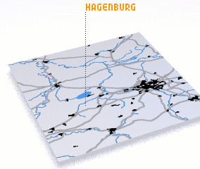 Places with similar names to Hagenburg, Germany ::
// Hagenberg (AT)
// Hegenberg (DE)
// Hegenberg (DE)
// Hagenbrück (DE)
// Hagenbroek (BE)
// Hogenberg (BE)
Disclaimer :: Information on this page comes without warranty of any kind |
||
|
Where is Hagenburg? Elevation and coordinates ::
Latitude (lat): 52°26'0"N Longitude (lon): 9°20'0"E
Elevation (approx.): 48m (map arrows pan, magnifying glasses zoom) |
||
|
Visiting Hagenburg? Hotel/Accommodation ::
Book a hotel in Hagenburg Travel Guide ::
Buy a travel guide for Germany rental cars ::
car rental offers GPS waypoint ::
download a GPX waypoint (PoI) of Hagenburg for your GPS receiver
|
||