|
search place name
|
||
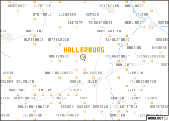
Hallerburg (Niedersachsen, Germany)Hallerburg is a town in the Niedersachsen region of Germany. An overview map of the region around Hallerburg is displayed below.
regional and 3d topo map of Hallerburg, Germany ::
Hallerburg airports ::
The nearest airport is HAJ - Hannover, located 32.8 km north of Hallerburg.
Other airports nearby include ZCN - Celle (51.6 km north east), BWE - Braunschweig Wolfsburg (59.8 km east), KSF - Kassel Calden (87.6 km south), PAD - Paderborn Lippstadt (97.6 km south west), Nearby towns ::
Alferde (1.1km west) //
Sorsum (1.9km south) //
Adensen (2.2km north east) //
Wittenburg (2.2km south west) //
Wülfingen (3.9km south) //
Boitzum (3.9km south) //
Holtensen (3.4km west) //
Elze (5.7km south) //
Mehle (5.7km south) //
Mittelrode (5.0km north west) //
Wülfinghausen (5.0km south west) //
Nordstemmen (4.5km east) //
Eldagsen (4.5km west) //
Gestorf (7.5km north) //
Sehlde (7.5km south) //
Vardegötzen (6.5km north east) //
Oerie (7.8km north) //
Thiedenwiese (7.8km north) //
Schulenburg (5.9km north east) //
Burgstemmen (5.9km south east) //
Quanthof (7.8km south) //
Bennigsen (8.2km north west) //
Glückauf (8.2km south west) //
Benstorf (8.7km south west) //
[all distances 'as the bird flies' and approximate]  Places with similar names to Hallerburg, Germany ::
// Hollerberg (DE)
Disclaimer :: Information on this page comes without warranty of any kind |
||
|
Where is Hallerburg? Elevation and coordinates ::
Latitude (lat): 52°10'0"N Longitude (lon): 9°43'0"E
Elevation (approx.): 76m (map arrows pan, magnifying glasses zoom) |
||
|
Visiting Hallerburg? Hotel/Accommodation ::
Book a hotel in Hallerburg Travel Guide ::
Buy a travel guide for Germany rental cars ::
car rental offers GPS waypoint ::
download a GPX waypoint (PoI) of Hallerburg for your GPS receiver
|
||