|
search place name
|
||
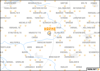
Harme (Niedersachsen, Germany)Harme is a town in the Niedersachsen region of Germany. An overview map of the region around Harme is displayed below.
regional and 3d topo map of Harme, Germany ::
Harme airports ::
The nearest airport is BRE - Bremen, located 54.4 km north east of Harme.
Other airports nearby include FMO - Muenster/osnabrueck Munster Osnabruck (74.2 km south west), WVN - Wilhelmshaven Mariensiel (86.2 km north), BRV - Bremerhaven (90.3 km north), GUT - Guetersloh Gutersloh (90.7 km south), Nearby towns ::
Molkenstraße (1.1km east) //
Bakum (1.1km east) //
Büschel (1.9km north) //
Westerbakum (2.2km north east) //
Vestrup (2.2km north west) //
Elmelage (2.2km east) //
Schwichteler (3.7km north) //
Weihe (2.9km south east) //
Südholz (2.9km south east) //
Märschendorf (3.9km south) //
Bokern (4.3km south east) //
Darrenkamp (4.3km north west) //
Hausstette (3.4km west) //
Carum (3.8km south west) //
Nordenbrok (5.7km north) //
Lohe (3.8km north east) //
Mintewede (5.7km north) //
Osterhausen (5.7km north) //
Bahlen (6.0km south) //
Deindrup (5.0km north east) //
Tenstedt (6.0km north) //
Schledehausen (4.5km east) //
Daren (4.9km east) //
Lohnerwiesen (6.5km south east) //
Strohe (6.5km north east) //
Spreda (5.8km north east) //
Palmpohl (7.7km north) //
Bühren (7.7km north) //
Siehenfelde (7.7km north) //
[all distances 'as the bird flies' and approximate]  Places with similar names to Harme, Germany ::
Disclaimer :: Information on this page comes without warranty of any kind |
||
|
Where is Harme? Elevation and coordinates ::
Latitude (lat): 52°44'0"N Longitude (lon): 8°10'0"E
Elevation (approx.): 29m (map arrows pan, magnifying glasses zoom) |
||
|
Visiting Harme? Hotel/Accommodation ::
Book a hotel in Harme Travel Guide ::
Buy a travel guide for Germany rental cars ::
car rental offers GPS waypoint ::
download a GPX waypoint (PoI) of Harme for your GPS receiver
|
||