|
search place name
|
||
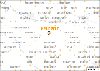
Heldritt (Bayern, Germany)Heldritt is a town in the Bayern region of Germany. An overview map of the region around Heldritt is displayed below.
regional and 3d topo map of Heldritt, Germany ::
Heldritt airports ::
The nearest airport is ERF - Erfurt, located 69.1 km north of Heldritt.
Other airports nearby include BYU - Bayreuth (73.5 km south east), HOQ - Hof Plauen (75.6 km east), NUE - Nuernberg Nurnberg (98.4 km south), GHF - Giebelstadt Aaf (99.8 km south west), Nearby towns ::
Hetschbach (1.9km north) //
Massenhausen (2.4km west) //
Lempertshausen (2.4km west) //
Schweighof (3.7km south) //
Grattstadt (3.0km north east) //
Veilsdorf (3.9km north) //
Elsa (3.9km south) //
Rodach (3.9km south) //
Adelhausen (3.5km west) //
Gauerstadt (5.6km south) //
Kloster Veilsdorf (5.7km north) //
Heßberg (5.7km north) //
Oettingshausen (4.0km south east) //
Roßfeld (4.0km south west) //
Schackendorf (6.0km north east) //
Breitenau (6.0km south east) //
Großwalbur (5.1km south east) //
Ahlstadt (4.7km east) //
Steinfeld (4.7km west) //
Eishausen (4.7km west) //
Niederndorf (7.4km south) //
Weitersroda (7.5km north) //
Mährenhausen (7.5km south) //
Hildburghausen (6.6km north west) //
Birkenfeld (6.6km north west) //
Carlshan (7.8km south) //
Rudelsdorf (6.0km south west) //
Goßmannsrod (8.2km north east) //
Harras (7.3km north east) //
[all distances 'as the bird flies' and approximate]  Places with similar names to Heldritt, Germany ::
// Haaltert (BE)
Disclaimer :: Information on this page comes without warranty of any kind |
||
|
Where is Heldritt? Elevation and coordinates ::
Latitude (lat): 50°22'0"N Longitude (lon): 10°48'0"E
Elevation (approx.): 393m (map arrows pan, magnifying glasses zoom) |
||
|
Visiting Heldritt? Hotel/Accommodation ::
Book a hotel in Heldritt Travel Guide ::
Buy a travel guide for Germany rental cars ::
car rental offers GPS waypoint ::
download a GPX waypoint (PoI) of Heldritt for your GPS receiver
|
||