|
search place name
|
||
Herpf (Thüringen, Germany)Herpf is a town in the Thüringen region of Germany. An overview map of the region around Herpf is displayed below.
regional and 3d topo map of Herpf, Germany ::

Herpf airports ::
The nearest airport is ERF - Erfurt, located 62.3 km north east of Herpf.
Other airports nearby include GHF - Giebelstadt Aaf (107.3 km south), ZNF - Hanau Aaf (107.9 km south west), HOQ - Hof Plauen (113.0 km east), KSF - Kassel Calden (113.7 km north west), Nearby towns ::
Rippershausen (2.2km north east) //
Solz (3.7km north) //
Ulsenheim (3.0km south west) //
Seeba (3.0km south west) //
Gleimershausen (3.9km south) //
Stepfershausen (3.0km north west) //
Melkers (3.0km north east) //
Brückenmühle (3.0km north east) //
Mehmels (5.6km north) //
Träbes (3.5km west) //
Dreißigacker (4.0km south east) //
Wahns (6.0km north west) //
Neuwahns (6.0km north west) //
Stedtlingen (6.0km south west) //
Bettenhausen (5.1km south west) //
Sülzfeld (6.0km south east) //
Walldorf (5.1km north east) //
Fischhaus (7.4km south) //
Geba (4.7km west) //
Sorghof (7.5km south) //
Haselbach (7.5km south) //
Thurmgut (7.5km south) //
Amalienruhe (8.2km south east) //
Wallbach (7.3km north east) //
Ruppers (8.8km south west) //
[all distances 'as the bird flies' and approximate] 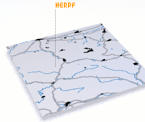 Places with similar names to Herpf, Germany :: Disclaimer :: Information on this page comes without warranty of any kind |
||
|
Where is Herpf? Elevation and coordinates ::
Latitude (lat): 50°35'0"N Longitude (lon): 10°20'0"E
Elevation (approx.): 334m (map arrows pan, magnifying glasses zoom) |
||
|
Visiting Herpf? Hotel/Accommodation ::
Book a hotel in Herpf Travel Guide ::
Buy a travel guide for Germany rental cars ::
car rental offers GPS waypoint ::
download a GPX waypoint (PoI) of Herpf for your GPS receiver
|
||