|
search place name
|
||
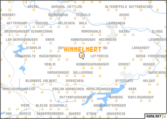
Himmelmert (Nordrhein-Westfalen, Germany)Himmelmert is a town in the Nordrhein-Westfalen region of Germany. An overview map of the region around Himmelmert is displayed below.
regional and 3d topo map of Himmelmert, Germany ::
Himmelmert airports ::
The nearest airport is ZCA - Arnsberg Menden, located 35.7 km north of Himmelmert.
Other airports nearby include DTM - Dortmund (41.6 km north), CGN - Cologne Koln Bonn (57.9 km south west), ESS - Essen Mulheim (66.7 km north west), DUS - Duesseldorf Dusseldorf (74.6 km west), Nearby towns ::
Hebberg (1.9km south) //
Dingeringhausen (2.2km north east) //
Hüinghausen (2.2km north west) //
Lichtringhausen (2.2km south east) //
Neuenhof (2.2km south east) //
Lettmecke (2.3km east) //
Kückelheim (2.3km east) //
Köbbinghausen (3.7km north) //
Bremcke (3.7km north) //
Grünenthal (2.3km west) //
Brenscheid (2.3km west) //
Sellenrade (3.7km south) //
Oesterau (3.0km north east) //
Dankelmert (3.0km north east) //
Windhausen (3.0km south east) //
Frehlinghausen (3.9km north) //
Weiße Ahe (3.0km north west) //
Ebberg (3.9km south) //
Holthausen (4.4km north east) //
Beukenbeul (4.4km south east) //
Mittelhagen (4.4km south west) //
Kiesbert (3.5km west) //
Papenkuhle (5.7km north) //
Friedlin (3.9km north west) //
Elsen (3.9km north west) //
Rinkscheid (5.7km south) //
Böddinghausen (6.0km north east) //
Hechmecke (5.1km north east) //
Freisemicke (6.0km south west) //
[all distances 'as the bird flies' and approximate]  Places with similar names to Himmelmert, Germany :: Disclaimer :: Information on this page comes without warranty of any kind |
||
|
Where is Himmelmert? Elevation and coordinates ::
Latitude (lat): 51°10'0"N Longitude (lon): 7°49'0"E
Elevation (approx.): 379m (map arrows pan, magnifying glasses zoom) |
||
|
Visiting Himmelmert? Hotel/Accommodation ::
Book a hotel in Himmelmert Travel Guide ::
Buy a travel guide for Germany rental cars ::
car rental offers GPS waypoint ::
download a GPX waypoint (PoI) of Himmelmert for your GPS receiver
|
||