|
search place name
|
||
Hintertal (Baden-Württemberg, Germany)Hintertal is a town in the Baden-Württemberg region of Germany. An overview map of the region around Hintertal is displayed below.
regional and 3d topo map of Hintertal, Germany ::

Hintertal airports ::
The nearest airport is SXB - Strassbourg Entzheim, located 42.7 km north west of Hintertal.
Other airports nearby include ZQL - Donaueschingen Villingen (50.1 km south east), ZCC - Baden-baden Baden Oos (51.2 km north), CMR - Colmar Houssen (61.5 km south west), STR - Stuttgart (90.8 km north east), Nearby towns ::
Fischerbach (1.9km south) //
Rot (1.9km north) //
Waldstein (2.2km south east) //
Unterharmersbach (2.2km north west) //
Eschbach (3.7km south) //
Geistacker (3.7km south) //
Oberentersbach (2.5km west) //
Billersberg (3.7km north) //
Einbach (3.1km south east) //
Vordertal (3.9km south) //
Welschbollenbach (3.1km south west) //
Buchwald (3.1km north west) //
Birach (3.1km north west) //
Funkenstadt (3.1km north west) //
Kirnback (3.9km north) //
Grün (3.9km north) //
Waldhäuser (4.5km north east) //
Langenberg (4.5km north east) //
Vorderhambach (4.5km north west) //
Hinterhambach (4.5km north west) //
Schottenhöfen (5.6km north) //
Echau (5.6km south) //
Weiler (5.6km south) //
Oberharmersbach (5.7km north) //
Neuenbach (4.1km south east) //
Hintertal (4.1km south east) //
Zell am Harmersbach (4.1km north west) //
Neuhausen (4.1km north west) //
Hausach-Dorf (6.1km south east) //
[all distances 'as the bird flies' and approximate] 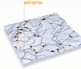 Places with similar names to Hintertal, Germany ::
Disclaimer :: Information on this page comes without warranty of any kind |
||
|
Where is Hintertal? Elevation and coordinates ::
Latitude (lat): 48°20'0"N Longitude (lon): 8°7'0"E
Elevation (approx.): 662m (map arrows pan, magnifying glasses zoom) |
||
|
Visiting Hintertal? Hotel/Accommodation ::
Book a hotel in Hintertal Travel Guide ::
Buy a travel guide for Germany rental cars ::
car rental offers GPS waypoint ::
download a GPX waypoint (PoI) of Hintertal for your GPS receiver
|
||