|
search place name
|
||
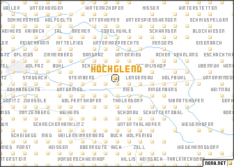
Hochglend (Bayern, Germany)Hochglend is a town in the Bayern region of Germany. An overview map of the region around Hochglend is displayed below.
regional and 3d topo map of Hochglend, Germany ::
Hochglend airports ::
The nearest airport is FDH - Friedrichshafen, located 35.4 km west of Hochglend.
Other airports nearby include ACH - St Gallen Altenrhein (37.7 km south west), OBF - Oberpfaffenhofen (107.6 km north east), AGB - Augsburg (110.1 km north east), ZRH - Zurich (110.2 km west), Nearby towns ::
Isnerberg (0.0km north) //
Obervorholz (1.2km west) //
Gründels (1.9km north) //
Untervorholz (1.2km west) //
Isnyberg (1.9km north) //
Rutzen (1.2km east) //
Ehrlach (1.9km south) //
Gestratz (1.9km south) //
Altenburg (1.9km south) //
Brugg (1.9km south) //
Eisenharz (2.2km north west) //
Dorenwaid (2.2km north east) //
Zwirkenberg (2.2km south west) //
Schmalenberg (2.2km south west) //
Ried (2.2km south east) //
Dinnensberg (2.2km south east) //
Hofs (2.5km west) //
Staudach (2.5km west) //
Burg (2.5km west) //
Eyb (2.5km west) //
Linzgis (2.5km west) //
Kreuzbühl (3.7km north) //
Lengersau (2.5km east) //
Altringenberg (2.5km east) //
Bad Altensberg (3.7km south) //
Schnaidt (3.1km north west) //
Semmersteig (3.9km north) //
Matzen (3.9km north) //
Bauschwanden (3.1km south west) //
[all distances 'as the bird flies' and approximate] 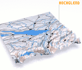 Places with similar names to Hochglend, Germany :: Disclaimer :: Information on this page comes without warranty of any kind |
||
|
Where is Hochglend? Elevation and coordinates ::
Latitude (lat): 47°40'0"N Longitude (lon): 9°59'0"E
Elevation (approx.): 698m (map arrows pan, magnifying glasses zoom) |
||
|
Visiting Hochglend? Hotel/Accommodation ::
Book a hotel in Hochglend Travel Guide ::
Buy a travel guide for Germany rental cars ::
car rental offers GPS waypoint ::
download a GPX waypoint (PoI) of Hochglend for your GPS receiver
|
||