|
search place name
|
||
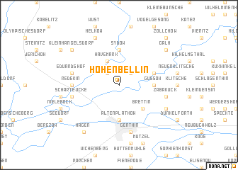
Hohenbellin (Sachsen-Anhalt, Germany)Hohenbellin is a town in the Sachsen-Anhalt region of Germany. An overview map of the region around Hohenbellin is displayed below.
regional and 3d topo map of Hohenbellin, Germany ::
Hohenbellin airports ::
The nearest airport is TXL - Berlin Tegel, located 77.9 km east of Hohenbellin.
Other airports nearby include THF - Berlin Tempelhof (85.2 km east), SXF - Berlin Schonefeld (93.9 km east), SZW - Schwerin Parchim (109.7 km north), BWE - Braunschweig Wolfsburg (109.7 km west), Nearby towns ::
Altbellin (2.2km north east) //
Kleinwulkow (2.2km north west) //
Havemark (3.9km north) //
Großwulkow (3.9km north) //
Brettin (4.3km south east) //
Altenplathow (5.6km south) //
Güssow (3.4km east) //
Sydow (5.6km north) //
Altenklitsche (3.9km north east) //
Redekin (4.5km west) //
Eduardshof (4.9km west) //
Zabakuck (4.9km east) //
Genthin (7.5km south) //
Scharteucke (4.9km west) //
Melkow (7.7km north) //
Annenhof (5.8km south east) //
Roßdorf (5.8km south east) //
Hagen (8.2km south west) //
Galm (7.2km north east) //
Briest (7.2km north west) //
Kleinmangelsdorf (7.2km north west) //
Zollchow (8.7km north east) //
Grille (8.7km north east) //
[all distances 'as the bird flies' and approximate] 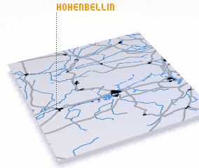 Places with similar names to Hohenbellin, Germany :: Disclaimer :: Information on this page comes without warranty of any kind |
||
|
Where is Hohenbellin? Elevation and coordinates ::
Latitude (lat): 52°28'0"N Longitude (lon): 12°9'0"E
Elevation (approx.): 34m (map arrows pan, magnifying glasses zoom) |
||
|
Visiting Hohenbellin? Hotel/Accommodation ::
Book a hotel in Hohenbellin Travel Guide ::
Buy a travel guide for Germany rental cars ::
car rental offers GPS waypoint ::
download a GPX waypoint (PoI) of Hohenbellin for your GPS receiver
|
||