|
search place name
|
||
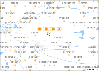
Hohenleipisch (Brandenburg, Germany)Hohenleipisch is a town in the Brandenburg region of Germany. An overview map of the region around Hohenleipisch is displayed below.
regional and 3d topo map of Hohenleipisch, Germany ::
Hohenleipisch airports ::
The nearest airport is DRS - Dresden, located 43.6 km south of Hohenleipisch.
Other airports nearby include BBJ - Bautzen (75.7 km south east), LEJ - Leipzig Halle (91.2 km west), AOC - Altenburg Nobitz (92.9 km south west), SXF - Berlin Schonefeld (97.9 km north), Nearby towns ::
Dreska (2.2km south west) //
Döllingen (3.0km south east) //
Kahla (3.9km south) //
Kraupa (3.5km west) //
Krauschütz (5.7km south) //
Elsterwerda (5.7km south) //
Holzhof (6.0km south west) //
Elsterwerda-Biehla (5.1km south west) //
Friedersdorf (7.4km north) //
Oppelhain (6.5km north east) //
Reißdamm (6.6km south east) //
Kotschka (6.6km south west) //
Gruhno (7.8km north) //
Plessa (5.9km south east) //
Ziegelscheune (7.2km north west) //
Prösen (8.2km south west) //
Plessa Süd (8.7km south east) //
Schadewitz (8.7km north west) //
[all distances 'as the bird flies' and approximate] 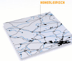 Places with similar names to Hohenleipisch, Germany :: Disclaimer :: Information on this page comes without warranty of any kind |
||
|
Where is Hohenleipisch? Elevation and coordinates ::
Latitude (lat): 51°30'0"N Longitude (lon): 13°33'0"E
Elevation (approx.): 138m (map arrows pan, magnifying glasses zoom) |
||
|
Visiting Hohenleipisch? Hotel/Accommodation ::
Book a hotel in Hohenleipisch Travel Guide ::
Buy a travel guide for Germany rental cars ::
car rental offers GPS waypoint ::
download a GPX waypoint (PoI) of Hohenleipisch for your GPS receiver
|
||