|
search place name
|
||
Hohenröhren (Bayern, Germany)Hohenröhren is a town in the Bayern region of Germany. An overview map of the region around Hohenröhren is displayed below.
regional and 3d topo map of Hohenröhren, Germany ::

Hohenröhren airports ::
The nearest airport is LNZ - Linz (Horsching), located 88.1 km south east of Hohenröhren.
Other airports nearby include SZG - Salzburg (132.1 km south), PRG - Prague Ruzyne (140.5 km north), MUC - Munich Munchen (146.5 km south west), KLV - Karlovy Vary (151.0 km north), Nearby towns ::
Heinrichsbrunn (0.0km north) //
Finsterau (1.9km north) //
Zwölfhäuser (1.9km south) //
Mauth (3.7km south) //
Vierhäuser (3.7km south) //
Chaloupky (3.9km north) //
Neuhütte (5.6km south) //
Stodŭlky (4.1km north east) //
Raimundsreut (6.1km south west) //
Knížecí Pláně (5.2km north east) //
Mitterfirmiansreut (5.2km east) //
Hinterfirmiansreut (5.2km east) //
Schönbrunn (6.7km south west) //
Annathal (6.7km south east) //
Alpe (6.1km south east) //
Schönbrunnerhäuser (7.4km south west) //
Oberkashof (8.3km south west) //
Unterkashof (8.3km south west) //
Bierhütte (8.9km south west) //
Schlichtenberg (8.9km south east) //
[all distances 'as the bird flies' and approximate] 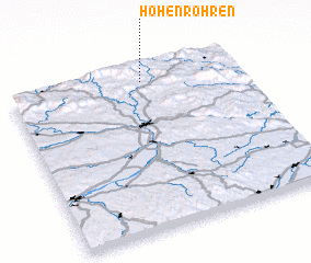 Places with similar names to Hohenröhren, Germany :: Disclaimer :: Information on this page comes without warranty of any kind |
||
|
Where is Hohenröhren? Elevation and coordinates ::
Latitude (lat): 48°55'0"N Longitude (lon): 13°35'0"E
Elevation (approx.): 912m (map arrows pan, magnifying glasses zoom) |
||
|
Visiting Hohenröhren? Hotel/Accommodation ::
Book a hotel in Hohenröhren Travel Guide ::
Buy a travel guide for Germany rental cars ::
car rental offers GPS waypoint ::
download a GPX waypoint (PoI) of Hohenröhren for your GPS receiver
|
||