|
search place name
|
||
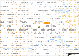
Hörbertsham (Bayern, Germany)Hörbertsham is a town in the Bayern region of Germany. An overview map of the region around Hörbertsham is displayed below.
regional and 3d topo map of Hörbertsham, Germany ::
Hörbertsham airports ::
The nearest airport is LNZ - Linz (Horsching), located 68.8 km south east of Hörbertsham.
Other airports nearby include SZG - Salzburg (82.7 km south), MUC - Munich Munchen (116.9 km west), PRG - Prague Ruzyne (189.9 km north), KLV - Karlovy Vary (192.0 km north), Nearby towns ::
Grünet (1.2km east) //
Wallham (1.9km south) //
Reisching (1.9km north) //
Parzham (2.2km south west) //
Dobl (2.2km south east) //
Fünfeichen (2.2km south west) //
Engertsham (2.2km south east) //
Obersimbach (2.2km south west) //
Aspertsham (2.2km north west) //
Dorf (2.2km south west) //
Kemating (2.2km north west) //
Gimplarn (2.2km south west) //
Aubach (2.2km north east) //
Moosbauer (2.5km west) //
Bad Höhenstadt (2.5km west) //
Gadham (2.5km west) //
Wartmanning (3.7km south) //
Endau (3.7km north) //
Kühloh (3.7km north) //
Kurzeichet (3.7km north) //
Buchet (3.1km south west) //
Pfenningbach (3.9km north) //
Gurlarn (3.9km north) //
Kleingern (3.9km north) //
Irsham (3.9km north) //
Berging (3.9km south) //
Untereichet (3.9km north) //
Scheuereck (4.4km north west) //
Neudöbl (4.4km south west) //
[all distances 'as the bird flies' and approximate]  Places with similar names to Hörbertsham, Germany :: Disclaimer :: Information on this page comes without warranty of any kind |
||
|
Where is Hörbertsham? Elevation and coordinates ::
Latitude (lat): 48°30'0"N Longitude (lon): 13°21'0"E
Elevation (approx.): 362m (map arrows pan, magnifying glasses zoom) |
||
|
Visiting Hörbertsham? Hotel/Accommodation ::
Book a hotel in Hörbertsham Travel Guide ::
Buy a travel guide for Germany rental cars ::
car rental offers GPS waypoint ::
download a GPX waypoint (PoI) of Hörbertsham for your GPS receiver
|
||