|
search place name
|
||
Hornstein (Baden-Württemberg, Germany)Hornstein is a town in the Baden-Württemberg region of Germany. An overview map of the region around Hornstein is displayed below.
regional and 3d topo map of Hornstein, Germany ::

Hornstein airports ::
The nearest airport is FDH - Friedrichshafen, located 53.2 km south of Hornstein.
Other airports nearby include ZQL - Donaueschingen Villingen (56.6 km west), STR - Stuttgart (63.8 km north), ACH - St Gallen Altenrhein (74.0 km south), ZRH - Zurich (89.5 km south west), Nearby towns ::
Bingen (1.2km east) //
Jungnau (3.1km north west) //
Hochberg (3.9km north) //
Laucherthal (3.9km south) //
Egelfingen (4.5km north east) //
Sigmaringen (4.5km south west) //
Hitzkofen (4.1km south east) //
Sigmaringendorf (5.7km south) //
Veringendorf (5.2km north west) //
Scheer (6.1km south east) //
Laiz (5.2km south west) //
Veringenstadt (7.8km north) //
Billafingen (6.2km north east) //
Emerfeld (7.4km north east) //
Inzigkofen (7.4km south west) //
Hipfelsberg (8.3km south east) //
Ennetach (8.9km south east) //
[all distances 'as the bird flies' and approximate] 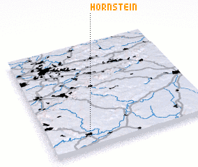 Places with similar names to Hornstein, Germany ::
// Hernstein (AT)
// Hornstein (AT)
// Herrenstein (DE)
// Hornstein (DE)
// Herrenstein (DE)
// Horná Ždáňa (SK)
// Horní Cetno (CZ)
// Horní Žitná (CZ)
Disclaimer :: Information on this page comes without warranty of any kind |
||
|
Where is Hornstein? Elevation and coordinates ::
Latitude (lat): 48°7'0"N Longitude (lon): 9°15'0"E
Elevation (approx.): 667m (map arrows pan, magnifying glasses zoom) |
||
|
Visiting Hornstein? Hotel/Accommodation ::
Book a hotel in Hornstein Travel Guide ::
Buy a travel guide for Germany rental cars ::
car rental offers GPS waypoint ::
download a GPX waypoint (PoI) of Hornstein for your GPS receiver
|
||