|
search place name
|
||
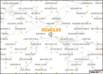
Ingweiler (Saarland, Germany)Ingweiler is a town in the Saarland region of Germany. An overview map of the region around Ingweiler is displayed below.
regional and 3d topo map of Ingweiler, Germany ::
Ingweiler airports ::
The nearest airport is SCN - Saarbruecken Saarbrucken, located 16.2 km west of Ingweiler.
Other airports nearby include RMS - Ramstein Ab (28.0 km north east), HHN - Frankfurt Hahn (75.9 km north), ZQF - Trier Fohren (76.6 km north west), ZQC - Speyer (82.6 km east), Nearby towns ::
Kaplaneihof (1.2km east) //
Schwarzenacker (1.9km north) //
Schwarzenbach (1.9km north) //
Wörschweiler (1.9km north) //
Einöd (1.9km north) //
Beeden (3.7km north) //
Freudenbergerhof (2.4km east) //
Bierbach (2.4km west) //
Wattweiler (3.7km south) //
Bliesbergrhof (3.9km north) //
Ernstweiler (3.0km south east) //
Bubenhausen (3.0km south east) //
Mölschbacherhof (3.9km south) //
Bombacherhof (3.6km east) //
Ernstweilerthalhof (3.6km east) //
Hengstbach (5.6km south) //
Homburg (5.7km north) //
Mittelbach (5.7km south) //
Zweibrücken (4.1km south east) //
Kirrberg (5.2km north east) //
Altstadt (6.1km north west) //
Mimbach (5.2km south west) //
Webenheim (5.2km south west) //
Ixheim (5.2km south east) //
Lautzkirchen (5.2km west) //
Limbach (6.6km north west) //
Blieskastel (6.1km south west) //
Bexbach (8.3km north west) //
Rimschweiler (7.4km south east) //
[all distances 'as the bird flies' and approximate] 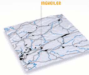 Places with similar names to Ingweiler, Germany ::
// Ingwiller (FR)
Disclaimer :: Information on this page comes without warranty of any kind |
||
|
Where is Ingweiler? Elevation and coordinates ::
Latitude (lat): 49°16'0"N Longitude (lon): 7°19'0"E
Elevation (approx.): 218m (map arrows pan, magnifying glasses zoom) |
||
|
Visiting Ingweiler? Hotel/Accommodation ::
Book a hotel in Ingweiler Travel Guide ::
Buy a travel guide for Germany rental cars ::
car rental offers GPS waypoint ::
download a GPX waypoint (PoI) of Ingweiler for your GPS receiver
|
||