|
search place name
|
||
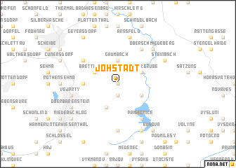
Jöhstadt (Sachsen, Germany)Jöhstadt is a town in the Sachsen region of Germany. An overview map of the region around Jöhstadt is displayed below.
regional and 3d topo map of Jöhstadt, Germany ::
Jöhstadt airports ::
The nearest airport is KLV - Karlovy Vary, located 37.3 km south of Jöhstadt.
Other airports nearby include AOC - Altenburg Nobitz (66.6 km north west), DRS - Dresden (83.1 km north east), HOQ - Hof Plauen (92.1 km west), PRG - Prague Ruzyne (94.7 km south east), Nearby towns ::
Schlössel (0.0km north) //
Dürrenberg (1.9km south) //
Neugrumbach (3.7km north) //
Grumbach (3.7km north) //
Brettmühle (3.0km north west) //
Schmalzgrube (3.0km north east) //
Kryštofovy Hamry (3.0km south east) //
Černý Potok (3.9km south) //
Kühberg (3.5km west) //
Königswalde (5.1km north west) //
Oberschaar (6.0km north east) //
Přísečnice (6.0km south east) //
Mezilesí u Přísečnice (7.4km south) //
Arnsfeld (7.5km north) //
Bärenstein (5.1km west) //
Vejprty (5.1km west) //
Oberschmiedeberg (6.6km north east) //
Mittelschmiedeberg (6.6km north east) //
Steinbach (6.0km north east) //
Dolina (7.8km south) //
Oberbärenstein (6.0km south west) //
Geyersdorf (8.2km north west) //
Rusová (8.2km south east) //
Niederschlag (7.3km south west) //
[all distances 'as the bird flies' and approximate]  Places with similar names to Jöhstadt, Germany ::
// Jestädt (DE)
Disclaimer :: Information on this page comes without warranty of any kind |
||
|
Where is Jöhstadt? Elevation and coordinates ::
Latitude (lat): 50°31'0"N Longitude (lon): 13°6'0"E
Elevation (approx.): 716m (map arrows pan, magnifying glasses zoom) |
||
|
Visiting Jöhstadt? Hotel/Accommodation ::
Book a hotel in Jöhstadt Travel Guide ::
Buy a travel guide for Germany rental cars ::
car rental offers GPS waypoint ::
download a GPX waypoint (PoI) of Jöhstadt for your GPS receiver
|
||