|
search place name
|
||
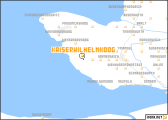
Kaiser Wilhelm Koog (Schleswig-Holstein, Germany)Kaiser Wilhelm Koog is a town in the Schleswig-Holstein region of Germany. An overview map of the region around Kaiser Wilhelm Koog is displayed below.
regional and 3d topo map of Kaiser Wilhelm Koog, Germany ::
Kaiser Wilhelm Koog airports ::
The nearest airport is BRV - Bremerhaven, located 54.7 km south west of Kaiser Wilhelm Koog.
Other airports nearby include XFW - Hamburg Finkenwerder (75.4 km south east), WVN - Wilhelmshaven Mariensiel (76.3 km south west), HAM - Hamburg (78.1 km south east), KEL - Kiel Holtenau (92.5 km north east), Nearby towns ::
Klein Dieksand (1.9km north) //
Schadendorf (1.1km east) //
Schafstedt (2.2km east) //
Dieksanderkoog (3.9km north) //
Kronprinzenkoog (2.9km north east) //
Marnerdeich (3.3km east) //
Neufelderkoog (6.0km south) //
Halbweg (4.4km east) //
Marne (4.4km east) //
Friedrichskoog (7.5km north) //
Rathjensdorf (7.5km north) //
Helserdeich (4.7km north east) //
Marner Neuenkoogsdeich (4.7km south east) //
Dieksanderkoog (6.5km north west) //
Rugenort (8.1km north west) //
Trennewurther Neuendeich (8.6km north east) //
[all distances 'as the bird flies' and approximate] 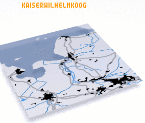 Places with similar names to Kaiser Wilhelm Koog, Germany :: Disclaimer :: Information on this page comes without warranty of any kind |
||
|
Where is Kaiser Wilhelm Koog? Elevation and coordinates ::
Latitude (lat): 53°57'0"N Longitude (lon): 8°56'0"E
Elevation (approx.): -2m (map arrows pan, magnifying glasses zoom) |
||
|
Visiting Kaiser Wilhelm Koog? Hotel/Accommodation ::
Book a hotel in Kaiser Wilhelm Koog Travel Guide ::
Buy a travel guide for Germany rental cars ::
car rental offers GPS waypoint ::
download a GPX waypoint (PoI) of Kaiser Wilhelm Koog for your GPS receiver
|
||