|
search place name
|
||
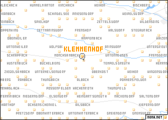
Klemmenhof (Bayern, Germany)Klemmenhof is a town in the Bayern region of Germany. An overview map of the region around Klemmenhof is displayed below.
regional and 3d topo map of Klemmenhof, Germany ::
Klemmenhof airports ::
The nearest airport is NUE - Nuernberg Nurnberg, located 43.5 km south east of Klemmenhof.
Other airports nearby include GHF - Giebelstadt Aaf (57.2 km west), BYU - Bayreuth (68.8 km east), HOQ - Hof Plauen (97.0 km north east), ERF - Erfurt (130.5 km north), Nearby towns ::
Dürrhof (0.0km north) //
Vollmannsdorf (1.2km west) //
Krumbach (1.2km west) //
Treppendorf (2.2km south east) //
Dippach (2.2km south west) //
Försdorf (2.4km east) //
Mönchsambach (2.4km west) //
Manndorf (2.4km west) //
Burgebrach (3.0km north east) //
Ampferbach (3.9km north) //
Dietendorf (3.9km north) //
Niederndorf (3.9km north) //
Decheldorf (3.9km south) //
Reichmannsdorf (3.9km south) //
Oberköst (4.4km south east) //
Albach (5.6km south) //
Steinsdorf (5.6km north) //
Frenshof (5.6km north) //
Wolfsbach (4.0km north west) //
Grasmannsdorf (4.0km north east) //
Hirschbrunn (4.0km south east) //
Grub (5.7km north) //
Schönbrunn (5.7km north) //
Reumannswind (6.1km south west) //
Unterneuses (4.8km east) //
Unterwinterbach (7.4km south) //
Wachenroth (7.4km south) //
Feilshof (5.1km east) //
Tempelsgreuth (5.1km east) //
[all distances 'as the bird flies' and approximate]  Places with similar names to Klemmenhof, Germany :: Disclaimer :: Information on this page comes without warranty of any kind |
||
|
Where is Klemmenhof? Elevation and coordinates ::
Latitude (lat): 49°49'0"N Longitude (lon): 10°43'0"E
Elevation (approx.): 310m (map arrows pan, magnifying glasses zoom) |
||
|
Visiting Klemmenhof? Hotel/Accommodation ::
Book a hotel in Klemmenhof Travel Guide ::
Buy a travel guide for Germany rental cars ::
car rental offers GPS waypoint ::
download a GPX waypoint (PoI) of Klemmenhof for your GPS receiver
|
||