|
search place name
|
||
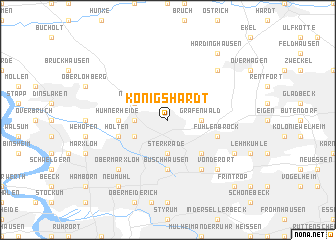
Königshardt (Nordrhein-Westfalen, Germany)Königshardt is a town in the Nordrhein-Westfalen region of Germany. An overview map of the region around Königshardt is displayed below.
regional and 3d topo map of Königshardt, Germany ::
nearby GPS traces from timatio ::
Königshardt airports ::
The nearest airport is ESS - Essen Mulheim, located 17.5 km south of Königshardt.
Other airports nearby include DUS - Duesseldorf Dusseldorf (29.6 km south), MGL - Moenchengladbach Monchengladbach (42.9 km south west), DTM - Dortmund (53.0 km east), ZCA - Arnsberg Menden (73.2 km east), Nearby towns ::
Sterkrade (3.7km south) //
Sterkrade Nord (2.3km west) //
Grafenwald (2.3km east) //
Dunkelschlag (3.0km south west) //
Neuköln (3.0km north west) //
Klosterhardt (4.4km south east) //
Buschhausen (5.6km south) //
Hühnerheide (3.5km west) //
Waldteich (3.9km south west) //
Holten (3.9km south west) //
Fuhlenbrock (3.9km south east) //
Osterfeld (6.0km south east) //
Obermarxloh (6.5km south west) //
Vonderort (6.5km south east) //
Holthausen (6.5km north east) //
Bottrop (5.9km south east) //
Neumühl (8.2km south west) //
Hardinghausen (8.2km north east) //
Frintrop (8.7km south east) //
[all distances 'as the bird flies' and approximate] 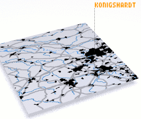 Places with similar names to Königshardt, Germany :: Disclaimer :: Information on this page comes without warranty of any kind |
||
|
Where is Königshardt? Elevation and coordinates ::
Latitude (lat): 51°33'0"N Longitude (lon): 6°51'0"E
Elevation (approx.): 69m (map arrows pan, magnifying glasses zoom) |
||
|
Visiting Königshardt? Hotel/Accommodation ::
Book a hotel in Königshardt Travel Guide ::
Buy a travel guide for Germany rental cars ::
car rental offers GPS waypoint ::
download a GPX waypoint (PoI) of Königshardt for your GPS receiver
|
||