|
search place name
|
||
Krügerswerder (Sachsen-Anhalt, Germany)Krügerswerder is a town in the Sachsen-Anhalt region of Germany. An overview map of the region around Krügerswerder is displayed below.
regional and 3d topo map of Krügerswerder, Germany ::

Krügerswerder airports ::
The nearest airport is SZW - Schwerin Parchim, located 61.5 km north of Krügerswerder.
Other airports nearby include TXL - Berlin Tegel (97.3 km east), THF - Berlin Tempelhof (108.4 km south east), BWE - Braunschweig Wolfsburg (113.4 km south west), RLG - Laage (117.2 km north), Nearby towns ::
Märsche (1.1km east) //
Wendemark (2.2km south west) //
Lennewitz (2.2km north east) //
Druidenhof (3.7km south) //
Quitzöbel (2.2km east) //
Werben (2.9km south east) //
Einhof (3.9km south) //
Haverland (2.9km north west) //
Legde (3.9km north) //
Parishof (4.3km south west) //
Behrendorf (5.6km south) //
Abbendorf (3.8km north west) //
Engelshof (5.0km south west) //
Neu Berge (6.0km south) //
Roddan (5.0km north east) //
Giesenslage (7.4km south) //
Neukirchen (4.5km west) //
Bad Wilsnack (7.4km north) //
Groß Lüben (7.7km north) //
Gnevsdorf (5.8km north west) //
Rengerslage (8.1km south west) //
Berge (8.1km south east) //
[all distances 'as the bird flies' and approximate] 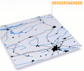 Places with similar names to Krügerswerder, Germany :: Disclaimer :: Information on this page comes without warranty of any kind |
||
|
Where is Krügerswerder? Elevation and coordinates ::
Latitude (lat): 52°53'0"N Longitude (lon): 11°57'0"E
Elevation (approx.): 24m (map arrows pan, magnifying glasses zoom) |
||
|
Visiting Krügerswerder? Hotel/Accommodation ::
Book a hotel in Krügerswerder Travel Guide ::
Buy a travel guide for Germany rental cars ::
car rental offers GPS waypoint ::
download a GPX waypoint (PoI) of Krügerswerder for your GPS receiver
|
||