|
search place name
|
||
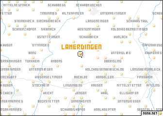
Lamerdingen (Bayern, Germany)Lamerdingen is a town in the Bayern region of Germany. An overview map of the region around Lamerdingen is displayed below.
regional and 3d topo map of Lamerdingen, Germany ::
Lamerdingen airports ::
The nearest airport is AGB - Augsburg, located 40.8 km north of Lamerdingen.
Other airports nearby include OBF - Oberpfaffenhofen (41.0 km east), FEL - Fuerstenfeldbruck Furstenfeldbruck (42.0 km east), MUC - Munich Munchen (83.8 km east), FDH - Friedrichshafen (102.2 km south west), Nearby towns ::
Dillishausen (1.9km south) //
Kleinkitzighofen (2.5km east) //
Gennach (3.9km north) //
Schwabmühlhausen (3.1km north east) //
Schwabaich (3.9km north) //
Falkenberg (3.9km north) //
Buchloe (5.6km south) //
Großkitzighofen (3.7km east) //
Amberg (4.2km south west) //
Westerringen (5.7km north) //
Holzhausen bei Buchloe (5.2km south east) //
Lindenberg (7.5km south) //
Oberigling (5.3km east) //
Honsolgen (6.7km south east) //
Hausen (7.8km south) //
Ostettringen (6.2km north west) //
Langerringen (7.8km north) //
Wiedergeltingen (7.4km south west) //
Siebnach (7.4km north west) //
Bronnen (8.3km south east) //
Kirch Siebnach (8.9km north west) //
Obermeitingen (8.9km north east) //
[all distances 'as the bird flies' and approximate]  Places with similar names to Lamerdingen, Germany :: Disclaimer :: Information on this page comes without warranty of any kind |
||
|
Where is Lamerdingen? Elevation and coordinates ::
Latitude (lat): 48°5'0"N Longitude (lon): 10°44'0"E
Elevation (approx.): 590m (map arrows pan, magnifying glasses zoom) |
||
|
Visiting Lamerdingen? Hotel/Accommodation ::
Book a hotel in Lamerdingen Travel Guide ::
Buy a travel guide for Germany rental cars ::
car rental offers GPS waypoint ::
download a GPX waypoint (PoI) of Lamerdingen for your GPS receiver
|
||