|
search place name
|
||
Lammerbach (Bayern, Germany)Lammerbach is a town in the Bayern region of Germany. An overview map of the region around Lammerbach is displayed below.
regional and 3d topo map of Lammerbach, Germany ::

Lammerbach airports ::
The nearest airport is MUC - Munich Munchen, located 117.1 km south west of Lammerbach.
Other airports nearby include KLV - Karlovy Vary (120.8 km north), BYU - Bayreuth (132.0 km north west), LNZ - Linz (Horsching) (137.4 km south east), NUE - Nuernberg Nurnberg (138.8 km west), Nearby towns ::
Höllnstein (1.9km north) //
Pirka (1.9km south) //
Buchberg (2.2km north west) //
Tresdorf (2.2km south west) //
Trum (3.7km north) //
Kaitersbach (3.7km north) //
Wettzell (3.7km north) //
Dumpf (2.4km west) //
Ruhmannsdorf (2.4km west) //
Berg (2.4km west) //
Kronberg (2.4km east) //
Sackenried (3.9km north) //
Ried (3.1km north west) //
Grub (3.1km north west) //
Leckern (3.9km north) //
Fichtental (3.1km south west) //
Steinhof (3.1km south west) //
Engelsdorf (3.1km south west) //
Haselbach (3.1km south east) //
Stein (3.9km south) //
Blossersberg (3.9km south) //
Viechtach (4.2km south) //
Hafenberg (4.4km north west) //
Weidenhof (4.4km north east) //
Hetzelsdorf (4.4km south west) //
Kammern (5.6km north) //
Grub (5.6km north) //
Arndorf (5.6km north) //
Heitzenzell (3.6km east) //
[all distances 'as the bird flies' and approximate] 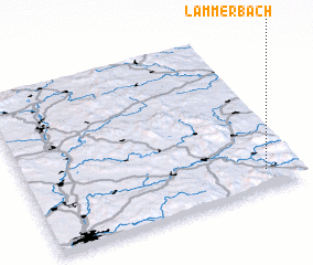 Places with similar names to Lammerbach, Germany :: Disclaimer :: Information on this page comes without warranty of any kind |
||
|
Where is Lammerbach? Elevation and coordinates ::
Latitude (lat): 49°7'0"N Longitude (lon): 12°53'0"E
Elevation (approx.): 516m (map arrows pan, magnifying glasses zoom) |
||
|
Visiting Lammerbach? Hotel/Accommodation ::
Book a hotel in Lammerbach Travel Guide ::
Buy a travel guide for Germany rental cars ::
car rental offers GPS waypoint ::
download a GPX waypoint (PoI) of Lammerbach for your GPS receiver
|
||