|
search place name
|
||
Laufen am Kocher (Baden-Württemberg, Germany)Laufen am Kocher is a town in the Baden-Württemberg region of Germany. An overview map of the region around Laufen am Kocher is displayed below.
regional and 3d topo map of Laufen am Kocher, Germany ::

Laufen am Kocher airports ::
The nearest airport is STR - Stuttgart, located 54.5 km south west of Laufen am Kocher.
Other airports nearby include GHF - Giebelstadt Aaf (79.8 km north), AGB - Augsburg (96.7 km south east), NUE - Nuernberg Nurnberg (107.7 km north east), ZQC - Speyer (111.2 km west), Nearby towns ::
Wengen (0.0km north) //
Eckenberg (1.9km south) //
Schönbronn (1.2km east) //
Waldmannshofen (1.9km south) //
Rübgarten (1.2km west) //
Krasberg (1.2km west) //
Knollenberg (1.2km west) //
Aichenrain (1.9km north) //
Haslach (2.2km north east) //
Heerberg (2.2km north west) //
Dinkbühl (2.4km east) //
Batschenhof (3.7km south) //
Mühlenberg (3.7km north) //
Wimberg (2.4km west) //
Algishofen (3.1km south east) //
Untergröningen (3.1km south east) //
Burren (3.9km south) //
Buchhof (3.9km south) //
Billingshalden (3.9km south) //
Wegstetten (3.1km north east) //
Kemnaten (3.9km south) //
Kohlwald (3.9km north) //
Hägeleshöfle (3.9km north) //
Grauhöfle (3.9km north) //
Seifertshofen (3.1km south west) //
Sulzbach am Kocher (3.9km north) //
Schmiedelfeld (3.9km north) //
Weiler (3.1km north west) //
Hohenberg (4.4km north east) //
[all distances 'as the bird flies' and approximate] 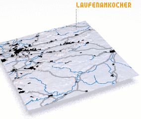 Places with similar names to Laufen am Kocher, Germany :: Disclaimer :: Information on this page comes without warranty of any kind |
||
|
Where is Laufen am Kocher? Elevation and coordinates ::
Latitude (lat): 48°56'0"N Longitude (lon): 9°52'0"E
Elevation (approx.): 349m (map arrows pan, magnifying glasses zoom) |
||
|
Visiting Laufen am Kocher? Hotel/Accommodation ::
Book a hotel in Laufen am Kocher Travel Guide ::
Buy a travel guide for Germany rental cars ::
car rental offers GPS waypoint ::
download a GPX waypoint (PoI) of Laufen am Kocher for your GPS receiver
|
||