|
search place name
|
||
Lumpzig (Thüringen, Germany)Lumpzig is a town in the Thüringen region of Germany. An overview map of the region around Lumpzig is displayed below.
regional and 3d topo map of Lumpzig, Germany ::

Lumpzig airports ::
The nearest airport is AOC - Altenburg Nobitz, located 17.2 km east of Lumpzig.
Other airports nearby include LEJ - Leipzig Halle (53.7 km north), HOQ - Hof Plauen (79.1 km south), ERF - Erfurt (92.0 km west), KLV - Karlovy Vary (94.9 km south east), Nearby towns ::
Dobitschen (1.2km east) //
Oberkossa (1.9km north) //
Naundorf (1.9km north) //
Braunshain (1.2km west) //
Großbraunshain (1.2km west) //
Kleintauscha (1.9km south) //
Prehna (2.2km south east) //
Graicha (2.2km south east) //
Wernsdorf (2.2km north west) //
Meucha (2.3km east) //
Rolika (2.3km east) //
Dobra (3.7km south) //
Wildenbörten (3.9km south) //
Rodameuschel (3.0km north east) //
Pontewitz (3.0km north east) //
Zweitschen (3.0km north east) //
Dobraschütz (3.0km north east) //
Zschöpperitz (3.0km south east) //
Kakau (3.9km south) //
Hartroda (3.9km south) //
Weißenborn (3.0km north west) //
Frankenau (3.0km south west) //
Hartha (3.0km south west) //
Kraasa (4.4km north east) //
Kostitz (4.4km north east) //
Pöhla (4.4km north east) //
Mohlis (4.4km south east) //
Kayna (4.4km north west) //
Roda (4.4km north west) //
[all distances 'as the bird flies' and approximate] 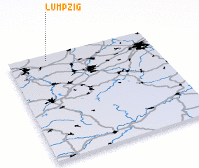 Places with similar names to Lumpzig, Germany :: Disclaimer :: Information on this page comes without warranty of any kind |
||
|
Where is Lumpzig? Elevation and coordinates ::
Latitude (lat): 50°57'0"N Longitude (lon): 12°16'0"E
Elevation (approx.): 265m (map arrows pan, magnifying glasses zoom) |
||
|
Visiting Lumpzig? Hotel/Accommodation ::
Book a hotel in Lumpzig Travel Guide ::
Buy a travel guide for Germany rental cars ::
car rental offers GPS waypoint ::
download a GPX waypoint (PoI) of Lumpzig for your GPS receiver
|
||