|
search place name
|
||
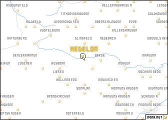
Medelon (Nordrhein-Westfalen, Germany)Medelon is a town in the Nordrhein-Westfalen region of Germany. An overview map of the region around Medelon is displayed below.
regional and 3d topo map of Medelon, Germany ::
Medelon airports ::
The nearest airport is PAD - Paderborn Lippstadt, located 49.9 km north of Medelon.
Other airports nearby include KSF - Kassel Calden (56.4 km north east), ZCA - Arnsberg Menden (64.0 km north west), DTM - Dortmund (83.2 km north west), GUT - Guetersloh Gutersloh (87.8 km north), Nearby towns ::
Dreislar (2.2km south east) //
Berge (2.3km east) //
Glindfeld (3.7km north) //
Braunshausen (5.6km south) //
Hesborn (3.9km south west) //
Medebach (5.1km north east) //
Hallenberg (6.0km south west) //
Liesen (5.1km south west) //
Somplar (7.4km south) //
Referinghausen (7.5km north) //
Deifeld (7.5km north) //
Neukirchen (6.6km south east) //
Wissinghausen (7.8km north) //
Rengershausen (7.8km south) //
Oberschledorn (8.2km north east) //
Küstelberg (7.2km north west) //
[all distances 'as the bird flies' and approximate] 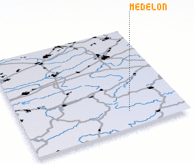 Places with similar names to Medelon, Germany ::
// Motla-in (MM)
// Mitylene (US)
// Matélon (CH)
// Madulein (CH)
// Madeline (US)
// Mittellohne (DE)
// Madalline (US)
// Media Luna (PA)
// Medelana (IT)
// Motolano (IT)
Disclaimer :: Information on this page comes without warranty of any kind |
||
|
Where is Medelon? Elevation and coordinates ::
Latitude (lat): 51°10'0"N Longitude (lon): 8°40'0"E
Elevation (approx.): 404m (map arrows pan, magnifying glasses zoom) |
||
|
Visiting Medelon? Hotel/Accommodation ::
Book a hotel in Medelon Travel Guide ::
Buy a travel guide for Germany rental cars ::
car rental offers GPS waypoint ::
download a GPX waypoint (PoI) of Medelon for your GPS receiver
|
||