|
search place name
|
||
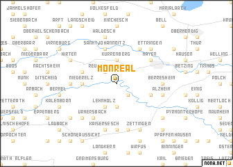
Monreal (Rheinland-Pfalz, Germany)Monreal is a town in the Rheinland-Pfalz region of Germany. An overview map of the region around Monreal is displayed below.
regional and 3d topo map of Monreal, Germany ::
Monreal airports ::
The nearest airport is ZNV - Koblenz Winningen, located 25.9 km east of Monreal.
Other airports nearby include HHN - Frankfurt Hahn (39.7 km south), SPM - Spangdahlem Ab (49.7 km south west), ZQF - Trier Fohren (55.6 km south west), CGN - Cologne Koln Bonn (63.0 km north), Nearby towns ::
Müsch (2.2km south east) //
Reudelsterz (2.2km north west) //
Düngenheim (3.7km south) //
Kürrenberg (3.7km north) //
Lehnholz (3.9km south) //
Niederelz (3.6km west) //
Kehrig (4.0km south east) //
Weiler (4.0km north west) //
Nitztal (5.7km north) //
Sankt Johann Nitz (5.7km north) //
Mayen (5.1km north east) //
Sankt Johann (6.0km north east) //
Urmersbach (6.0km south west) //
Allenz (4.7km east) //
Berresheim (4.7km east) //
Eulgem (7.4km south) //
Anschau (4.7km west) //
Alzheim (5.1km east) //
Hambuch (7.5km south) //
Kaisersesch (7.5km south) //
Waldesch (7.5km north) //
Kirchwald (7.5km north) //
Masburg (6.6km south west) //
Ettringen (6.6km north east) //
Gamlen (7.8km south) //
Zettingen (7.8km south) //
Hirten (6.0km north west) //
Luxem (6.0km north west) //
Kaifenheim (7.3km south east) //
[all distances 'as the bird flies' and approximate] 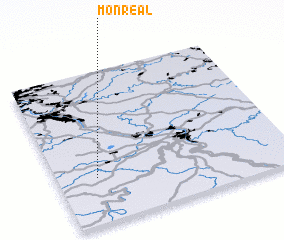 Places with similar names to Monreal, Germany ::
Disclaimer :: Information on this page comes without warranty of any kind |
||
|
Where is Monreal? Elevation and coordinates ::
Latitude (lat): 50°18'0"N Longitude (lon): 7°10'0"E
Elevation (approx.): 293m (map arrows pan, magnifying glasses zoom) |
||
|
Visiting Monreal? Hotel/Accommodation ::
Book a hotel in Monreal Travel Guide ::
Buy a travel guide for Germany rental cars ::
car rental offers GPS waypoint ::
download a GPX waypoint (PoI) of Monreal for your GPS receiver
|
||