|
search place name
|
||
Narsdorf (Sachsen, Germany)Narsdorf is a town in the Sachsen region of Germany. An overview map of the region around Narsdorf is displayed below.
regional and 3d topo map of Narsdorf, Germany ::

Narsdorf airports ::
The nearest airport is AOC - Altenburg Nobitz, located 15.3 km west of Narsdorf.
Other airports nearby include LEJ - Leipzig Halle (56.9 km north west), DRS - Dresden (74.7 km east), KLV - Karlovy Vary (91.6 km south), HOQ - Hof Plauen (101.3 km south west), Nearby towns ::
Mutzscheroda (1.2km east) //
Wickershain (1.9km north) //
Seifersdorf (1.2km west) //
Breitenborn (2.2km north east) //
Dölitzsch (2.2km south west) //
Geithain (3.7km north) //
Carsdorf (2.3km east) //
Obergräfenhain (3.7km south) //
Wittgendorf (3.0km north east) //
Bruchheim (3.0km north west) //
Himmelhartha (3.9km south) //
Kleinschlaisdorf (3.9km south) //
Rathendorf (3.0km south west) //
Stollsdorf (4.4km north east) //
Altdorf (4.4km north west) //
Mark Ottenhain (5.6km north) //
Wenigossa (3.5km west) //
Oberpickenhain (3.5km west) //
Haide (5.7km north) //
Kolka (4.0km north west) //
Ossa (4.0km north west) //
Hellerdorf (4.0km north east) //
Niederelsdorf (5.7km south) //
Altzschillen (4.0km south east) //
Wechselburg (4.0km south east) //
Oberelsdorf (5.7km south) //
Königsfeld (6.0km north east) //
Köttwitzsch (5.1km north east) //
Noßwitz (5.1km north east) //
[all distances 'as the bird flies' and approximate] 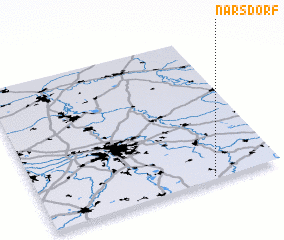 Places with similar names to Narsdorf, Germany ::
// Neuersdorf (DE)
Disclaimer :: Information on this page comes without warranty of any kind |
||
|
Where is Narsdorf? Elevation and coordinates ::
Latitude (lat): 51°1'0"N Longitude (lon): 12°43'0"E
Elevation (approx.): 260m (map arrows pan, magnifying glasses zoom) |
||
|
Visiting Narsdorf? Hotel/Accommodation ::
Book a hotel in Narsdorf Travel Guide ::
Buy a travel guide for Germany rental cars ::
car rental offers GPS waypoint ::
download a GPX waypoint (PoI) of Narsdorf for your GPS receiver
|
||