|
search place name
|
||
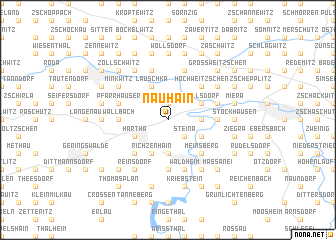
Nauhain (Sachsen, Germany)Nauhain is a town in the Sachsen region of Germany. An overview map of the region around Nauhain is displayed below.
regional and 3d topo map of Nauhain, Germany ::
Nauhain airports ::
The nearest airport is AOC - Altenburg Nobitz, located 37.7 km south west of Nauhain.
Other airports nearby include DRS - Dresden (53.7 km east), LEJ - Leipzig Halle (63.5 km north west), KLV - Karlovy Vary (101.8 km south), BBJ - Bautzen (106.7 km east), Nearby towns ::
Wendishain (1.9km north) //
Steina (2.2km south east) //
Saalbach (2.3km east) //
Diedenhain (3.7km south) //
Töpeln (3.0km north east) //
Wöllsdorf (3.0km north east) //
Klosterbuch (3.9km north) //
Lauschka (3.9km north) //
Flemmingen (3.0km south west) //
Neuhausen (3.0km south east) //
Hartha (3.0km south west) //
Richzenhain (3.9km south) //
Hochweitzschen (4.4km north east) //
Aschershain (4.4km south west) //
Meinsberg (4.4km south east) //
Limmritz (3.5km east) //
Wallbach (3.5km west) //
Neuschönberg (5.6km south) //
Gilsberg (5.6km south) //
Pfarrhäuser (4.0km north west) //
Möckwitz (4.0km north east) //
Schweta (4.0km north east) //
Altenhof (5.7km north) //
Scheergrund (5.7km north) //
Waldheim (5.7km south) //
Ober Rauschenthal (5.7km south) //
Heiligenborn (5.7km south) //
Minkwitz (5.1km north west) //
Höckendorf (5.1km north east) //
[all distances 'as the bird flies' and approximate]  Places with similar names to Nauhain, Germany ::
Disclaimer :: Information on this page comes without warranty of any kind |
||
|
Where is Nauhain? Elevation and coordinates ::
Latitude (lat): 51°7'0"N Longitude (lon): 13°0'0"E
Elevation (approx.): 282m (map arrows pan, magnifying glasses zoom) |
||
|
Visiting Nauhain? Hotel/Accommodation ::
Book a hotel in Nauhain Travel Guide ::
Buy a travel guide for Germany rental cars ::
car rental offers GPS waypoint ::
download a GPX waypoint (PoI) of Nauhain for your GPS receiver
|
||