|
search place name
|
||
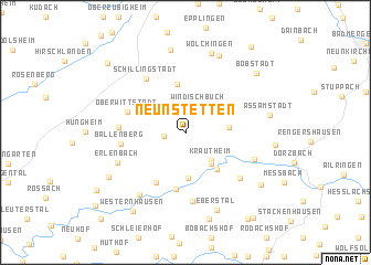
Neunstetten (Baden-Württemberg, Germany)Neunstetten is a town in the Baden-Württemberg region of Germany. An overview map of the region around Neunstetten is displayed below.
regional and 3d topo map of Neunstetten, Germany ::
Neunstetten airports ::
The nearest airport is GHF - Giebelstadt Aaf, located 36.8 km north east of Neunstetten.
Other airports nearby include MHG - Mannheim City (79.8 km west), ZQC - Speyer (85.1 km west), STR - Stuttgart (85.1 km south), ZNF - Hanau Aaf (96.3 km north west), Nearby towns ::
Oberndorf (1.5km west) //
Schollhof (2.5km north west) //
Windischbuch (2.9km north) //
Krautheim (3.3km south east) //
Krautheimberg (3.6km south east) //
Krautheimtal (3.6km south east) //
Horrenbach (2.9km east) //
Gommersdorf (4.6km south) //
Altkrautheim (4.2km south east) //
Schwabhausen (5.0km north) //
Marlach (5.7km south) //
Heßlingshof (5.4km south) //
Oberwittstadt (4.4km north west) //
Ballenberg (4.4km west) //
Unterwittstadt (4.4km west) //
Schillingstadt (6.1km north west) //
Altdorf (6.9km south) //
Sindeldorf (6.9km south) //
Unterginsbach (5.8km south east) //
Klepsau (5.2km south east) //
Erlenbach (5.4km south west) //
Winzenhofen (6.9km south west) //
Wölchingen (8.1km north) //
Eberstal (8.0km south) //
Boxberg (8.0km north) //
Angeltürn (8.4km north) //
Assamstadt (5.8km east) //
Diebach (8.8km south) //
Aschhausen (6.8km south west) //
[all distances 'as the bird flies' and approximate]  Places with similar names to Neunstetten, Germany ::
Disclaimer :: Information on this page comes without warranty of any kind |
||
|
Where is Neunstetten? Elevation and coordinates ::
Latitude (lat): 49°24'42"N Longitude (lon): 9°36'38"E
Elevation (approx.): 303m (map arrows pan, magnifying glasses zoom) |
||
|
Visiting Neunstetten? Hotel/Accommodation ::
Book a hotel in Neunstetten Travel Guide ::
Buy a travel guide for Germany rental cars ::
car rental offers GPS waypoint ::
download a GPX waypoint (PoI) of Neunstetten for your GPS receiver
|
||