|
search place name
|
||
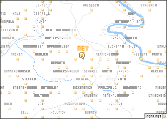
Ney (Rheinland-Pfalz, Germany)Ney is a town in the Rheinland-Pfalz region of Germany. An overview map of the region around Ney is displayed below.
regional and 3d topo map of Ney, Germany ::
Ney airports ::
The nearest airport is ZNV - Koblenz Winningen, located 15.8 km north of Ney.
Other airports nearby include HHN - Frankfurt Hahn (32.5 km south west), ZQF - Trier Fohren (64.2 km south west), SPM - Spangdahlem Ab (64.6 km west), FRA - Frankfurt Main (74.3 km east), Nearby towns ::
Dieler (1.2km west) //
Kratzenburg (1.2km east) //
Buchholz (1.9km north) //
Halsenbach (2.2km south east) //
Basselscheid (3.7km south) //
Ehr (2.4km east) //
Niedergondershausen (3.0km south west) //
Herschwiesen (3.0km north west) //
Windhausen (3.0km north west) //
Liesenfeld (3.9km south) //
Schwall (3.9km south) //
Gondershausen (4.4km south west) //
Lamscheid (4.4km south east) //
Emmelshausen (4.4km south east) //
Mermicherhof (3.6km east) //
Niedert (5.6km south) //
Layen Mühle (5.6km south) //
Thörlingen (5.6km south) //
Pfaffenheck (5.7km north) //
Obergondershausen (4.0km south west) //
Mermuth (4.0km south west) //
Ehrerheide (4.0km south east) //
Hübingen (4.0km north west) //
Oppenhausen (4.0km north west) //
Reifenthal (5.7km south) //
Udenhausen (6.0km north west) //
Dörth (5.1km south east) //
Mühltal (6.0km north east) //
Nörtershausen (5.1km north west) //
[all distances 'as the bird flies' and approximate] 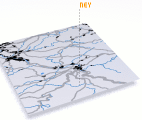 Places with similar names to Ney, Germany ::
Disclaimer :: Information on this page comes without warranty of any kind |
||
|
Where is Ney? Elevation and coordinates ::
Latitude (lat): 50°11'0"N Longitude (lon): 7°32'0"E
Elevation (approx.): 373m (map arrows pan, magnifying glasses zoom) |
||
|
Visiting Ney? Hotel/Accommodation ::
Book a hotel in Ney Travel Guide ::
Buy a travel guide for Germany rental cars ::
car rental offers GPS waypoint ::
download a GPX waypoint (PoI) of Ney for your GPS receiver
|
||