|
search place name
|
||
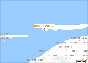
Norderney (Niedersachsen, Germany)Norderney is a town in the Niedersachsen region of Germany. An overview map of the region around Norderney is displayed below.
regional and 3d topo map of Norderney, Germany ::
Norderney airports ::
The nearest airport is NRD - Norderney, located 5.4 km east of Norderney.
Other airports nearby include BMK - Borkum (31.4 km west), EME - Emden (34.8 km south), WVN - Wilhelmshaven Mariensiel (63.6 km east), GRQ - Groningen Eelde (74.9 km south west), Nearby towns ::
Honnewarf (7.1km south east) //
Westerloog (8.1km south east) //
Osterloog (8.1km south east) //
[all distances 'as the bird flies' and approximate] 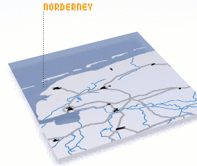 Places with similar names to Norderney, Germany ::
// Nardaran (AZ)
// Nardaran (AZ)
// Nardaran (AZ)
// Neeroeteren (BE)
// Nordrona (SE)
// Norra Törne (SE)
Disclaimer :: Information on this page comes without warranty of any kind |
||
|
Where is Norderney? Elevation and coordinates ::
Latitude (lat): 53°42'0"N Longitude (lon): 7°9'0"E
Elevation (approx.): 2m (map arrows pan, magnifying glasses zoom) |
||
|
Visiting Norderney? Hotel/Accommodation ::
Book a hotel in Norderney Travel Guide ::
Buy a travel guide for Germany rental cars ::
car rental offers GPS waypoint ::
download a GPX waypoint (PoI) of Norderney for your GPS receiver
|
||