|
search place name
|
||
Obergladbach (Hessen, Germany)Obergladbach is a town in the Hessen region of Germany. An overview map of the region around Obergladbach is displayed below.
regional and 3d topo map of Obergladbach, Germany ::

Obergladbach airports ::
The nearest airport is FRA - Frankfurt Main, located 38.6 km east of Obergladbach.
Other airports nearby include ZNV - Koblenz Winningen (42.9 km north west), HHN - Frankfurt Hahn (56.5 km west), ZNF - Hanau Aaf (68.0 km east), MHG - Mannheim City (78.4 km south east), Nearby towns ::
Fischbach (1.2km east) //
Langenseifen (1.9km north) //
Niedergladbach (2.4km west) //
Ramschied (3.9km north) //
Watzelhain (3.9km north) //
Hausen vor der Höhe (3.0km south east) //
Hof Mappen (3.9km south) //
Bärstadt (3.6km east) //
Heimbach (6.0km north east) //
Bad Schwalbach (5.1km north east) //
Wisper (6.0km north west) //
Springen (6.0km north west) //
Kemel (7.4km north) //
Hallgarten (7.5km south) //
Mappershain (7.5km north) //
Dickschied (5.1km west) //
Hettenhain (6.0km north east) //
Eichberg (7.8km south) //
Neuhof (7.8km south) //
Adolphseck (7.3km north east) //
Nauroth (7.3km north west) //
Hof Schönberg (8.2km north west) //
Wachholderhof (8.2km south east) //
Lindschied (8.2km north east) //
Kiedrich (8.8km south east) //
Stephanshausen (8.8km south west) //
[all distances 'as the bird flies' and approximate] 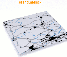 Places with similar names to Obergladbach, Germany ::
// Obergladbach (DE)
Disclaimer :: Information on this page comes without warranty of any kind |
||
|
Where is Obergladbach? Elevation and coordinates ::
Latitude (lat): 50°6'0"N Longitude (lon): 8°1'0"E
Elevation (approx.): 457m (map arrows pan, magnifying glasses zoom) |
||
|
Visiting Obergladbach? Hotel/Accommodation ::
Book a hotel in Obergladbach Travel Guide ::
Buy a travel guide for Germany rental cars ::
car rental offers GPS waypoint ::
download a GPX waypoint (PoI) of Obergladbach for your GPS receiver
|
||